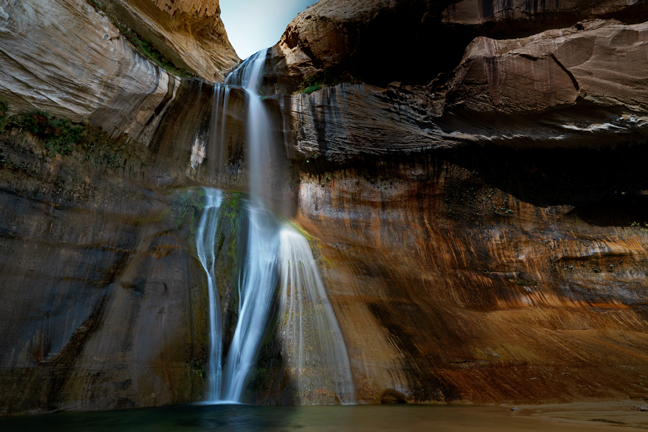
Lower Calf Creek Falls, UT, September 2020
Twelve miles south of the Burr Trail Road turn-off on Utah 12 is the Lower Calf Creek Falls Trailhead. The falls are 130 feet high with a deep swimming hole at their base and are reached on a six-mile out and back sandy trail that mostly follows the creek. About halfway along you can see two Fremont granaries and pictograph panels dating from AD 1200 high up on the east wall of the canyon. The trail and swimming hole are often crowded during summer.
©Rich Beckman
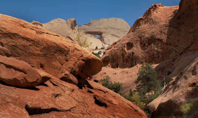
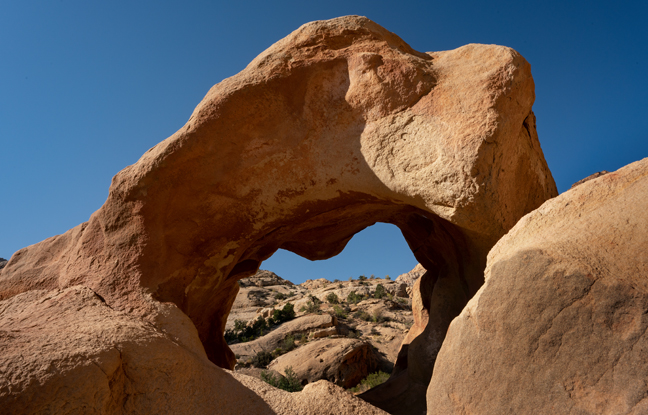
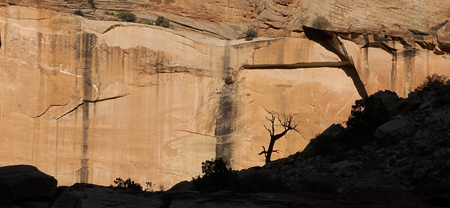
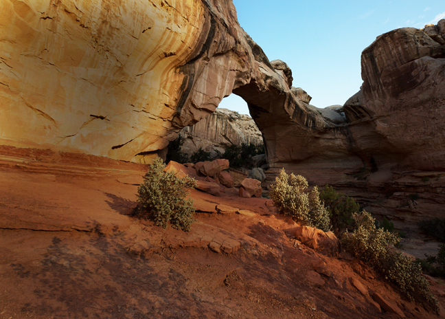
Pontiac Window (12S-496858-4290503, Span: 36 ft, Height: 15.5 ft.) Upper Muley Twist Canyon Trail, Capitol Reef National Park, UT, September 2020
Thirty-three miles east of the Burr Trail Road turn-off from Utah 12 is the trailhead for the Upper Muley Twist Canyon Trail. The trail features numerous large natural arches, including Pontiac Window, Trinity Arch, Muley Twist Double Arch, Muley Arch, Saddle Arch and Upper Muley Twist Arch. From Boulder to the west boundary of Capitol Reef, the Burr Trail Road is paved. There are two parking areas for the trail. The one closer to the arches, the Strike Valley Overlook parking area, requires a high-clearance 4WD vehicle.
©Rich Beckman
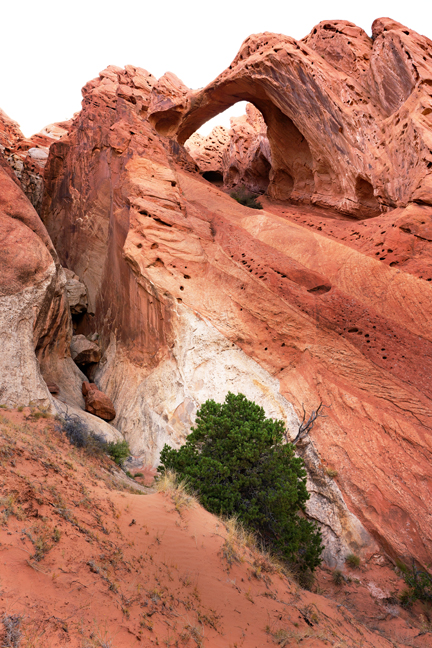
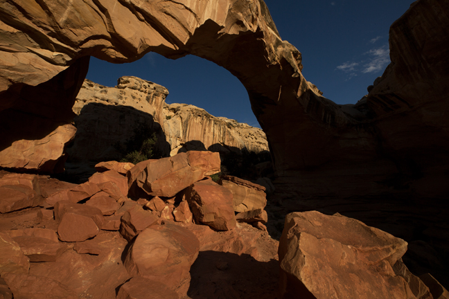
Muley Arch (12S-494735-4194590, Span: 130 ft, Height: 25 ft.) Upper Muley Twist Canyon Trail, Capitol Reef National Park, UT, September 2020
Thirty-three miles east of the Burr Trail Road turn-off from Utah 12 is the trailhead for the Upper Muley Twist Canyon Trail. The trail features numerous large natural arches, including Pontiac Window, Trinity Arch, Muley Twist Double Arch, Muley Arch, Saddle Arch and Upper Muley Twist Arch. From Boulder to the west boundary of Capitol Reef, the Burr Trail Road is paved. There are two parking areas for the trail. The one closer to the arches, the Strike Valley Overlook parking area, requires a high-clearance 4WD vehicle.
©Rich Beckman
Saddle Arch (12S-494589-4194868, Span: 55 ft, Height: 50 ft.) Upper Muley Twist Canyon Trail, Capitol Reef National Park, UT, September 2020
Thirty-three miles east of the Burr Trail Road turn-off from Utah 12 is the trailhead for the Upper Muley Twist Canyon Trail. The trail features numerous large natural arches, including Pontiac Window, Trinity Arch, Muley Twist Double Arch, Muley Arch, Saddle Arch and Upper Muley Twist Arch. From Boulder to the west boundary of Capitol Reef, the Burr Trail Road is paved. There are two parking areas for the trail. The one closer to the arches, the Strike Valley Overlook parking area, requires a high-clearance 4WD vehicle.
©Rich Beckman
Moonrise, Notom-Bullfrog Road, Capitol Reef National Park, UT, September 2020
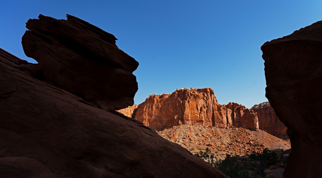
Continuing east one mile on the Burr Trail Road from Upper Muley Twist Canyon turn-off are the famous Burr Trail Road Switchbacks that drop about 800 feet in half a mile to the canyon floor. Less than a mile from the bottom of the switchbacks is the intersection with Notom-Bullfrog Road. The main park road, Utah 24, intersects with Notom-Bullfrog Road 36 miles to the north.
©Rich Beckman
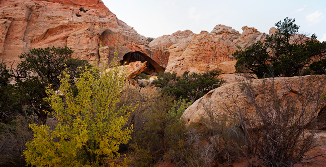
Unnamed Arch, Grand Wash Trail, Capitol Reef National Park, UT, September 2020
The northeast Grand Wash Trailhead is 4.5 miles to the west of the Notom-Bullfrog Road junction with Utah 24. It is at the lower end of the canyon and empties into the Fremont River.
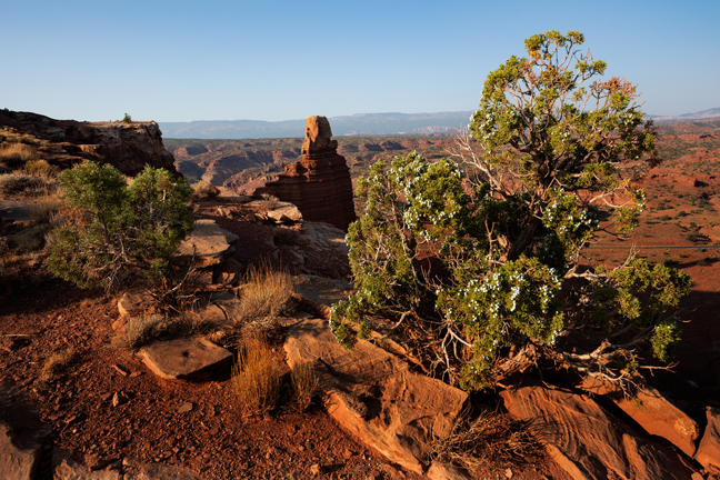
Capitol Reef National Park was established in 1971, although it had been a National Monument since 1937. It officially opened to the public in 1950, but easy road access did not exist until 1962, when Utah State Route 24 was completed. The park is long and narrow covering 60 miles north to south, but never stretching more than six miles east to west.
The majority of the nearly 100 mile long up-thrust formation called the Waterpocket Fold—a rocky spine extending from Thousand Lake Mountain to Lake Powell—is preserved within the park. "Waterpockets" are small depressions formed in the sandstone layers as they are eroded by water, and are common throughout the fold at Capitol Reef.
The small town of Fruita, inside the park, has more than 2,500 fruit trees some of which were originally planted by Mormon pioneers. Today, the town is federally-owned and visitors can stroll through the orchards and eat fruit fresh off the trees.
©Rich Beckman
Grand Wash Trail, Capitol Reef National Park, UT, September 2020
The northeast Grand Wash Trailhead is 4.5 miles to the west of the Notom-Bullfrog Road junction with Utah 24. It is at the lower end of the canyon and empties into the Fremont River.
Capitol Reef National Park was established in 1971, although it had been a National Monument since 1937. It officially opened to the public in 1950, but easy road access did not exist until 1962, when Utah State Route 24 was completed. The park is long and narrow covering 60 miles north to south, but never stretching more than six miles east to west.
The majority of the nearly 100 mile long up-thrust formation called the Waterpocket Fold—a rocky spine extending from Thousand Lake Mountain to Lake Powell—is preserved within the park. "Waterpockets" are small depressions formed in the sandstone layers as they are eroded by water, and are common throughout the fold at Capitol Reef.
The small town of Fruita, inside the park, has more than 2,500 fruit trees some of which were originally planted by Mormon pioneers. Today, the town is federally-owned and visitors can stroll through the orchards and eat fruit fresh off the trees.
©Rich Beckman
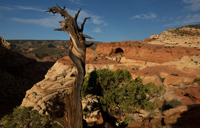
Cassidy Arch (12S-480253-4234805, Span: 70 ft., Height: 100 ft.), Capitol Reef National Park, UT, July 2017
Cassidy Arch is named after Butch Cassidy, whose band of outlaws were said to frequent the area in the 1890s. Their legendary hideout – Robber’s Roost, an area of steep and narrow slot canyons – is about 70 miles to the east.
©Rich Beckman
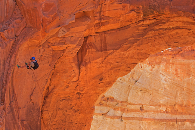
Rappelling from Cassidy Arch (12S-480253-4234805, Span: 70 ft., Height: 100 ft.), Capitol Reef National Park, UT, July 2017
Cassidy Arch is named after Butch Cassidy, whose band of outlaws were said to frequent the area in the 1890s. Their legendary hideout – Robber’s Roost, an area of steep and narrow slot canyons – is about 70 miles to the east.
©Rich Beckman
Grand Wash Road, Capitol Reef National Park, September 2020
After descending Cassidy Arch Trail, it is about .75 miles to the southwest Grand Wash Trailhead at the end of Grand Wash Road, a dirt spur off Scenic Drive.
©Rich Beckman
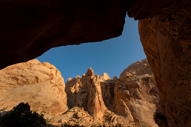
Capitol Gorge Trail, Capitol Reef National Park, September 2020
After descending Cassidy Arch Trail, it is about .75 miles to the southwest Grand Wash Trailhead at the end of Grand Wash Road, a dirt spur off Scenic Drive. At the end of Scenic Drive is the Capitol Gorge spur road and the Capitol Gorge Trailhead. The trail passes a petroglyph panel and the Pioneer Register and leads to a side trail to the Tanks, an area of water-filled (during winter and spring) potholes.
©Rich Beckman
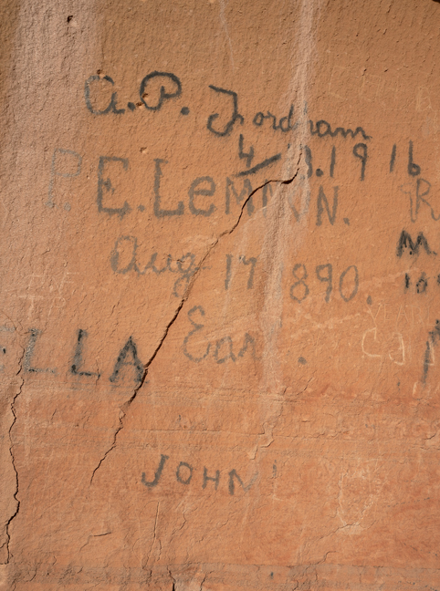
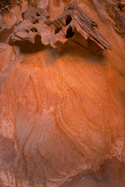
Pioneer Register, Capitol Gorge Trail, Capitol Reef National Park, September 2020
After descending Cassidy Arch Trail, it is about .75 miles to the southwest Grand Wash Trailhead at the end of Grand Wash Road, a dirt spur off Scenic Drive. At the end of Scenic Drive is the Capitol Gorge spur road and the Capitol Gorge Trailhead. The trail passes a petroglyph panel and the Pioneer Register and leads to a side trail to the Tanks, an area of water-filled (during winter and spring) potholes.
©Rich Beckman
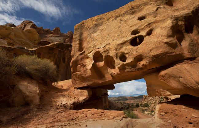
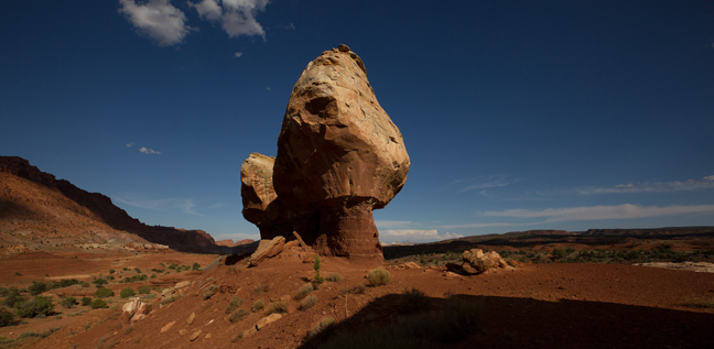
Hickman Natural Bridge (12S-479502-4238178, Span: 130 ft., Height: 70 ft.), July 2017
After descending Cassidy Arch Trail, it is about .75 miles to the southwest Grand Wash Trailhead which is about 3.4 miles down the Scenic Drive from the park’s Visitor’s Center and the junction of Utah 24. One mile to the east, on Utah 24, is the Hickman Natural Bridge Trailhead.
©Rich Beckman
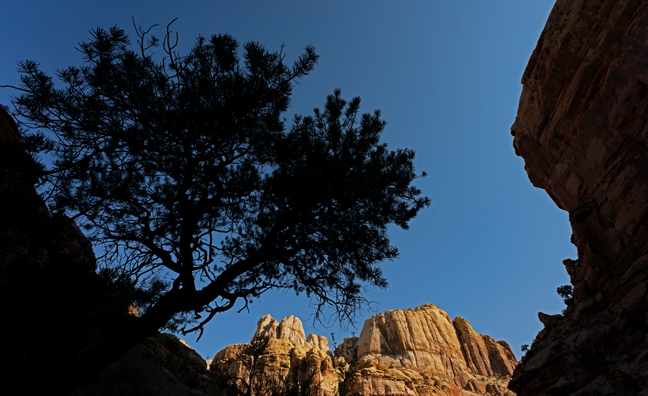
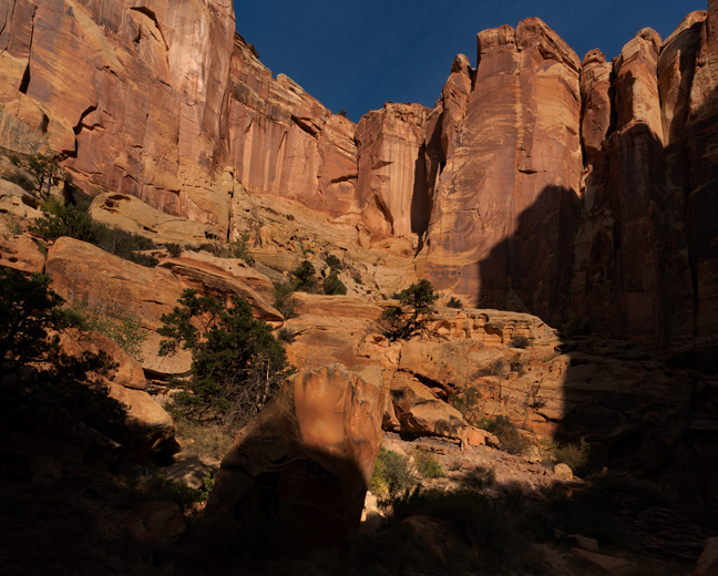
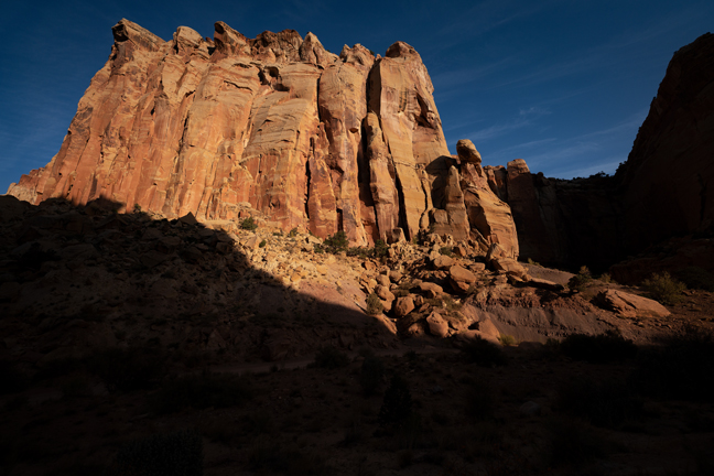
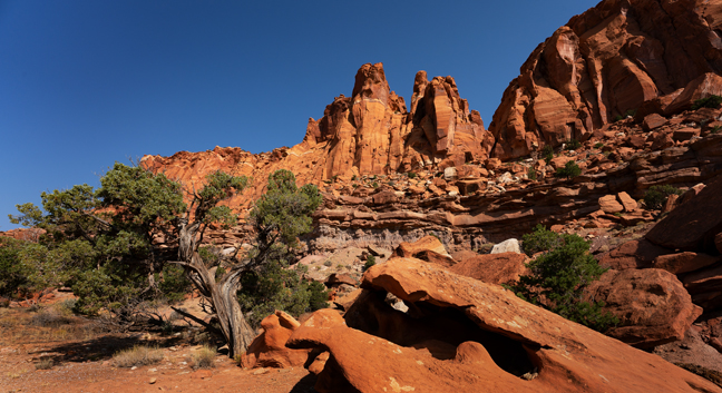
Chimney Rock Trail, Capitol Reef National Park, UT, September 2020
Three miles west of the park Visitor’s Center, which is located at the junction of Utah 24 and Scenic Drive, is the Chimney Rock Trailhead. The 3.5 mile trail, just inside the west entrance to the park, passes the 300 ft. tall solitary pillar of Moenkopi sandstone and then loops around the top of Mummy Cliffs.
©Rich Beckman
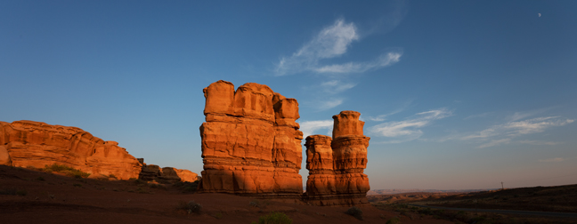
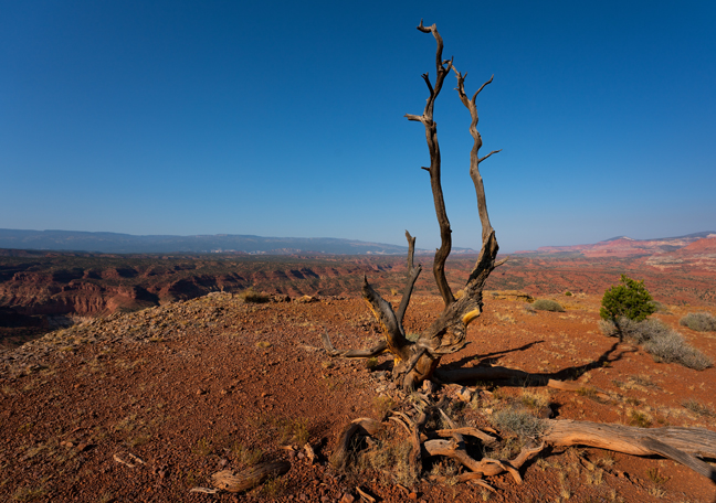
Twin Rocks, Capitol Reef National Park, UT, July 2017
One mile inside the park’s west boundary, on Utah 24, is the Twin Rocks formation.
©Rich Beckman
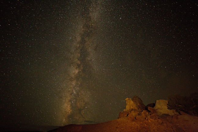
Milky Way over Twin Rocks, Capitol Reef National Park, UT, July 2017
One mile inside the park’s west boundary, on Utah 24, is the Twin Rocks formation. In April 2015, the Park was named a Gold-tier International Dark Sky Park by the International Dark Sky Association.
©Rich Beckman
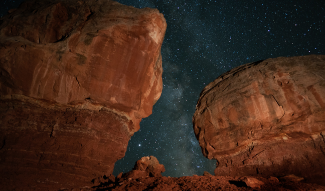
Milky Way and Jupiter between Twin Rocks, Capitol Reef National Park, UT, September 2020
One mile inside the park’s west boundary, on Utah 24, is the Twin Rocks formation. In April 2015, the Park was named a Gold-tier International Dark Sky Park by the International Dark Sky Association.
©Rich Beckman