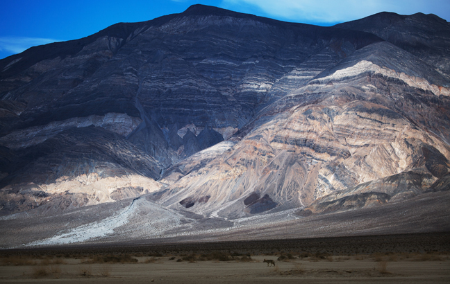

Panamint Butte, Death Valley National Park, CA
Panamint Butte is best seen from the flats between Towne Pass and Panamint Springs along NV190, the main park road. Coyotes are often seen along this segment of the road, mostly because of irresponsible tourists who stop and feed them scraps. The Butte is a popular backcountry climb and there is wreckage from a WWII-era training plane that crashed into a steep hillside southwest of Towne Point.
©Rich Beckman
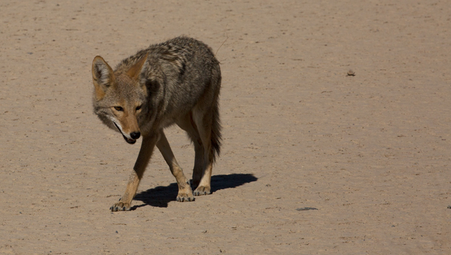
Coyote, Death Valley National Park, CA
Coyotes are common throughout the park and are often seen begging along roadsides. We watched people feeding them scraps and baiting them with food for photographs. It will only lead to their demise, either as road kill or as pests. I sent the license plate number to the ranger in hopes that they ban these idiots from our national parks.
©Rich Beckman
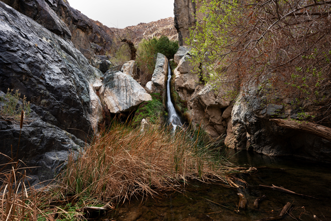
Lower Darwin Falls, Death Valley National Park, CA
Lower Darwin Falls is a waterfall located on the western edge of Death Valley National Park, just west of the settlement of Panamint Springs, California. The Falls is one of the only permanent fresh water sources in the park and water pipes line the trail. A spring-fed creek flows through the narrow canyon, allowing grasses, trees and other forms of life that don’t exist in other parts of the park to flourish.
©Rich Beckman
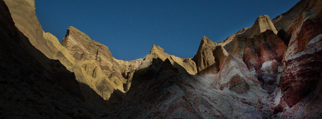
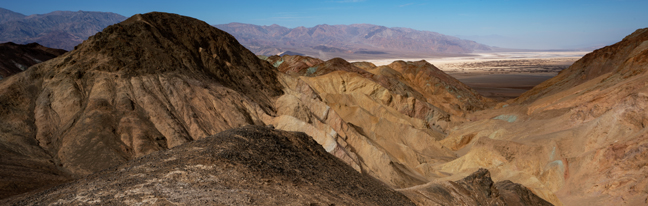
Golden Canyon, Death Valley National Park, CA
The Golden Canyon Interpretive Trail is one of the most popular in the Park. The trailhead is only a few miles from the Furnace Creek lodges and it is a relatively easy hike until the scramble up to the base of Red Cathedral. There is supposedly a trail guide available at the trailhead, but don't count on it. I've hiked the trail numerous times and the trail guide box has always been empty. The red mudstone and mosaic conglomerate canyon walls are best lit by morning light and by mid-morning the trail of cars will have spilled onto the roadsides from the smallish parking lot, so arrive early.
©Rich Beckman
Golden Canyon, Death Valley National Park, CA
The gradual uphill gravel wash into Golden Canyon passes through a rocky narrows before opening into a colorful badlands capped by the fluted headwall of Red Cathedral. The wash continues for a mile to the upper canyon and then there is a ¼ mile scramble up to Red Cathedral. There are numerous valleys off the main wash that lead to colorful striated peaks and rocky outcrops that are worth exploring.
©Rich Beckman
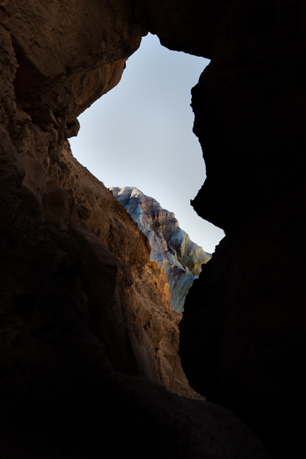
Golden Canyon, Death Valley National Park, CA
The view looking back through the narrow slot canyon that leads up to the base of Red Cathedral.
©Rich Beckman
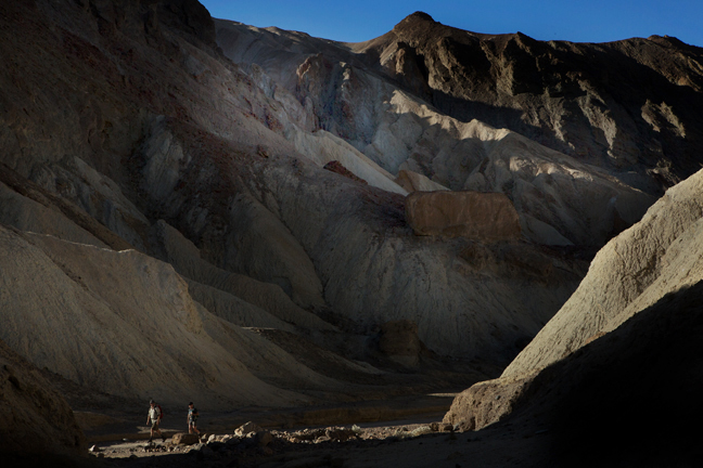
Golden Canyon, Death Valley National Park, CA
At the entry to Red Cathedral, after a 1/4 mile scramble to the base of the rocks, we climbed a short pathway that provided a clear view of the Panamint Mountain Range across the valley floor. The Range includes Telescope Peak, the highest point in the Park at 11.049 ft. and Bennets Peak at 9,980 ft.
©Rich Beckman
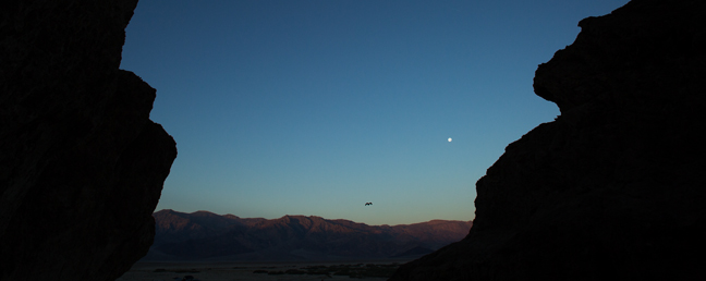
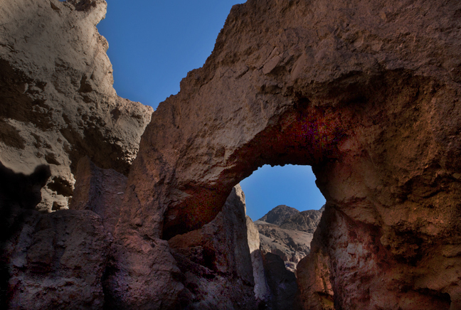
Moonset, Natural Bridge Trail, Death Valley National Park, CA
The natural bridge in Natural Bridge Canyon is about .3 miles from the trailhead, although the mile-long trail also features faults, chutes and mud drippings. The 50-foot tall bridge created by differential erosion spans the width of the canyon. Continue past the bridge to see a long vertical dry chute from an ancient waterfall and a sloping green marble dry falls.
©Rich Beckman
Natural Bridge Trail, Death Valley National Park, CA
The natural bridge in Natural Bridge Canyon is about .3 miles from the trailhead, although the mile-long trail also features faults, chutes and mud drippings. The 50-foot tall bridge created by differential erosion spans the width of the canyon. Continue past the bridge to see a long vertical dry chute from an ancient waterfall and a sloping green marble dry falls.
©Rich Beckman
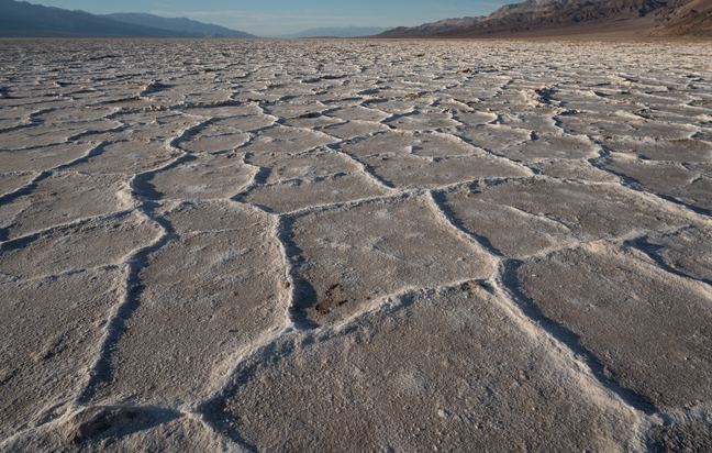
Badwater Basin, Death Valley National Park, CA
Badwater Basin is the lowest point in North America, with an elevation of 282 ft. below sea level. There is a spring-fed pool near the road, but the accumulated salts make it undrinkable, thus the name Badwater. Repeated freeze/thaw and evaporation cycles gradually push the thin salt crust into hexagonal honeycomb shapes. The salt flats (Sodium Chloride) in Badwater Basin cover nearly 200 square miles. They receive an average rainfall of 1.9 inches, but that is easily overwhelmed by a 150-inch annual evaporation rate.
©Rich Beckman
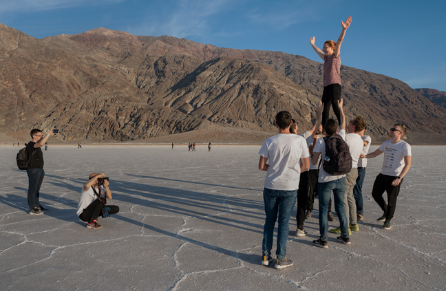
Badwater Basin, Death Valley National Park, CA
Large crowds gather every evening at Badwater Basin, the lowest point in North America, with an elevation of 282 ft. below sea level and each time I go, the walk out to an untrammeled area is longer and longer. It was almost a mile to reach a pristine area of the salt flats in February 2020. At least there is plenty of entertainment along the way.
©Rich Beckman
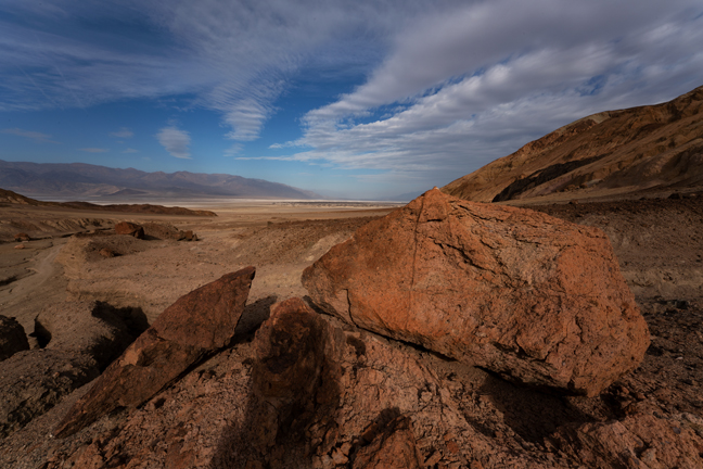
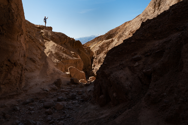
Desolation Canyon, Death Valley National Park, CA
About 1.7 miles miles south of the often crowded Golden Canyon on Badwater Road is the secluded Desolation Canyon in the Black Mountains. The canyon walls feature large patches of colorful iron minerals, including green Chlorite and Nontronite as well as reddish and purple Hematites and yellow patches of Limonite. The first half of the 3.6 mile out and back trail is almost all uphill and includes 6-8 ft. dry falls that need to be scaled. The turnaround is at the ridgeline after a final 750-foot steep uphill climb that overlooks Artist's Drive to the west and the Valley floor to the east.
©Rich Beckman
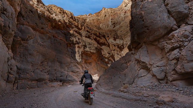
The Narrows, Titus Canyon, Death Valley National Park, CA
The Titus Canyon Road is a 27-mile high-clearance four-wheel drive road that begins two miles east of Park Boundary Road in Nevada. It climbs through Titanothere Canyon, over Red Pass, through the ghost town of Leadfield and past Klare Spring before entering the Narrows. It is one-way (east to west) except for the last three miles. It is often closed due to snow, mud or washouts and prone to flash flooding. It is the most popular back-country road in the Park and in good weather, dirt bikes and trucks reach the narrows by mid-morning making hiking much less pleasurable.
©Rich Beckman
The Narrows, Titus Canyon, Death Valley National Park, CA
The hiking portion of Titus Canyon is usually limited to the slot canyon on the western end of a 27-mile four-wheel drive road that begins two miles east of Park Boundary Road. The back-country road climbs through Titanothere Canyon, over Red Pass, through the ghost town of Leadfield and past Klare Spring before entering the Narrows.
©Rich Beckman
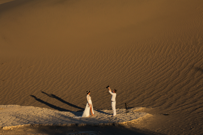
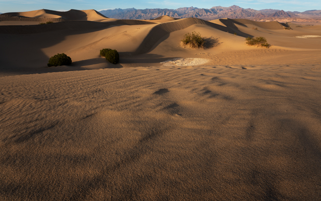
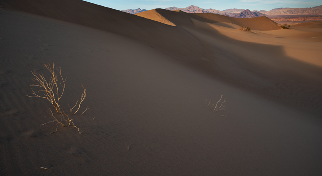
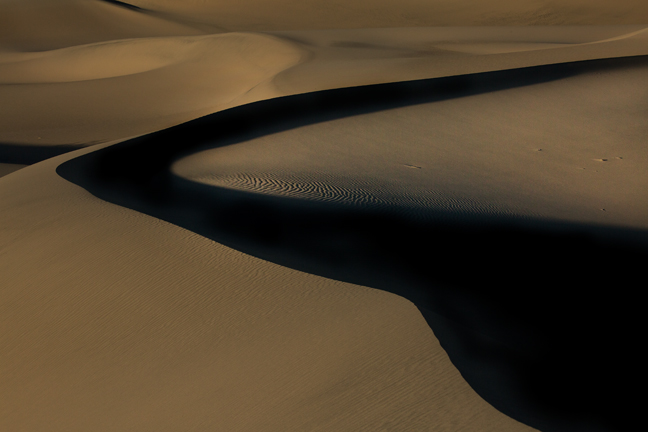
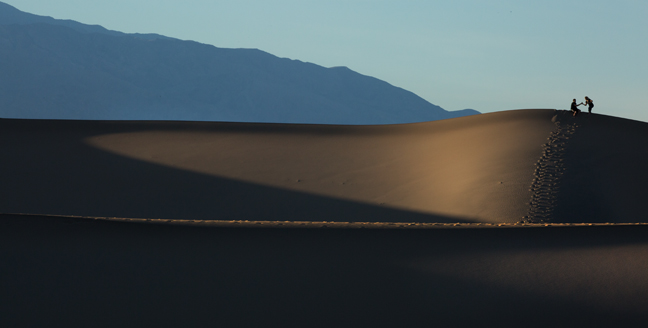
Bridal Photos, Mesquite Flat Sand Dunes, Death Valley National Park, CA
The Mesquite Flat Sand Dunes are at the northern end of the valley floor and are surrounded by mountains on nearly all sides. The area is easily accessible and has been used for several movies including films in the Star Wars series. The depth of the sand at its crest is 130–140 feet, actually small compared to other less accessible dunes in the park that have sand depths of up to 600–700 feet. In between many of the dunes are stands of creosote bush and some mesquite on the sand and dried mud, which used to cover the valley before the dunes intruded.
©Rich Beckman
Mesquite Flat Sand Dunes, Death Valley National Park, CA
The Mesquite Flat Sand Dunes are at the northern end of the valley floor and are surrounded by mountains on nearly all sides. The area is easily accessible and has been used for several movies including films in the Star Wars series. The depth of the sand at its crest is 130–140 feet, actually small compared to other less accessible dunes in the park that have sand depths of up to 600–700 feet. In between many of the dunes are stands of creosote bush and some mesquite on the sand and dried mud, which used to cover the valley before the dunes intruded.
©Rich Beckman
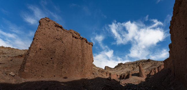
Pinnacles and Rock Wall, Death Valley National Park, CA
About 38 miles south of the 190 turnoff along the left side of Badwater Road is the unmarked Room Canyon. The Canyon features the tallest pinnacles in Death Valley National Park. You can see a number of pinnacles from the road, but climbing to them will not lead you to Room Canyon. The actual entrance to the Canyon is about a half mile to the east and accessed by hiking up the alluvial fan to the canyon mouth. There are numerous narrows and short slot canyons along the short route to the main room of the canyon.
©Rich Beckman
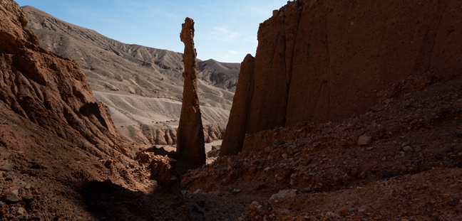
Room Pinnacle #1, Room Canyon, Death Valley National Park, CA
Before reaching the main room, look to your left against the canyon wall to see the tallest pinnacle in Death Valley National Park. It is red and quite narrow and features a crown. You can climb the unstable rocky slope up to and above the base of the pinnacle.
©Rich Beckman
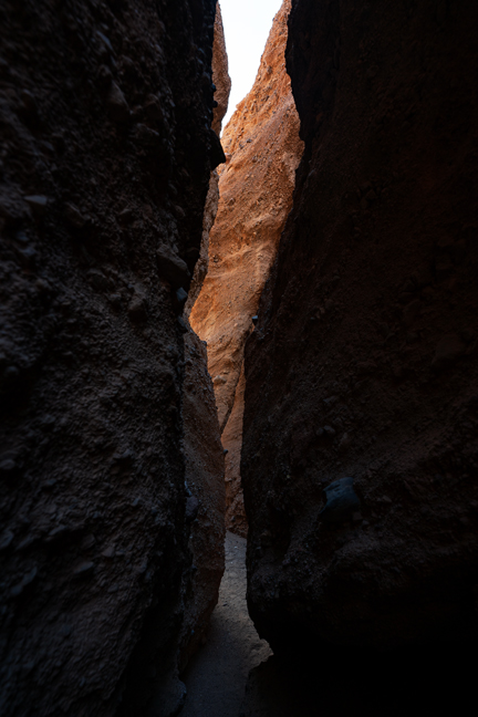
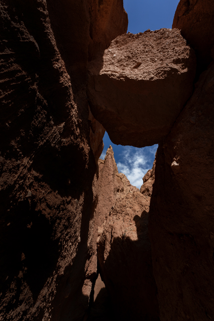
Room Canyon, Death Valley National Park, CA
There are numerous narrow slot canyons to explore that branch off from the main canyon. This one requires a tight squeeze and belly crawl to reach the large boulder blocking the entry to another room. This is looking back at the entrance.
©Rich Beckman
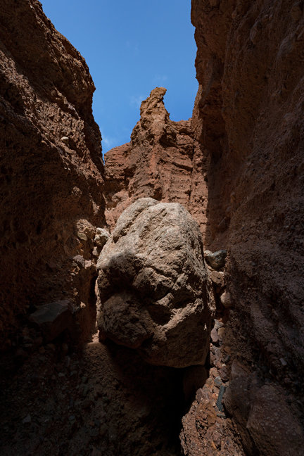
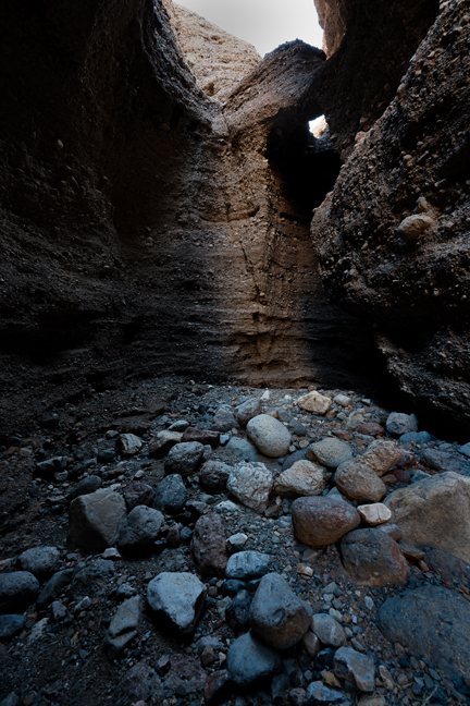
Room Canyon, Death Valley National Park, CA
After a short belly crawl, the slot canyon opens up into another small room that requires climbing up to and over a large boulder. There are more pinnacles and formations on the other side although I did not explore beyond this point.
©Rich Beckman
Room Canyon, Death Valley National Park, CA
This is the entryway to the majestic main room of Room Canyon, an enclosed amphitheater. There is a climbable dry fall at the end of the canyon that opens up to more pinnacles and formations that we did not climb.
©Rich Beckman
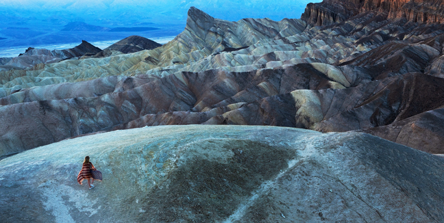
Zabriskie Point, Death Valley National Park, CA
One of the most accessible and visited overlooks in the Park is Zabriskie Point, part of the Amargosa Range composed of five million year old sediments from Furnace Creek Lake. It is named for Christian Zabriskie, former vice-president of Pacific Coast Borax, whose renowned 20-Mule Teams transported borax from its mines in Death Valley. Like at Badwater Basin, there are always crowds documenting their time at the Point. Here, a woman staged an Instagram fashion shoot draped in a worn American flag.
©Rich Beckman
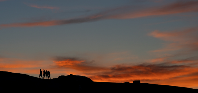
Sunset Selfies, Zabriskie Point, Death Valley National Park, CA
©Rich Beckman
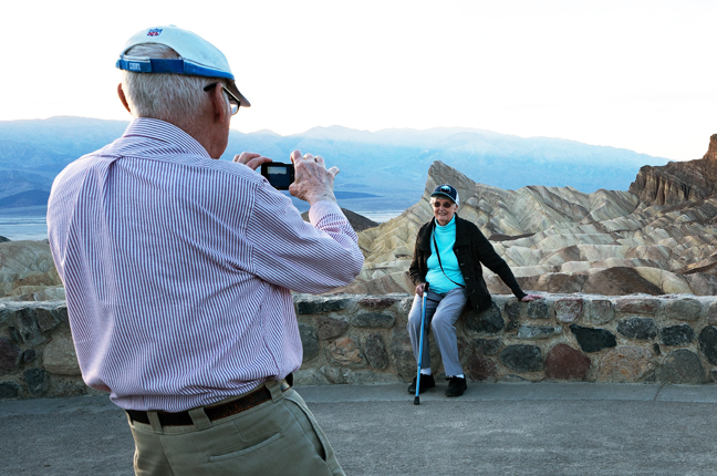
Portrait in Front of Manly Beacon and Red Cathedral, Zabriskie Point, Death Valley National Park, CA
©Rich Beckman
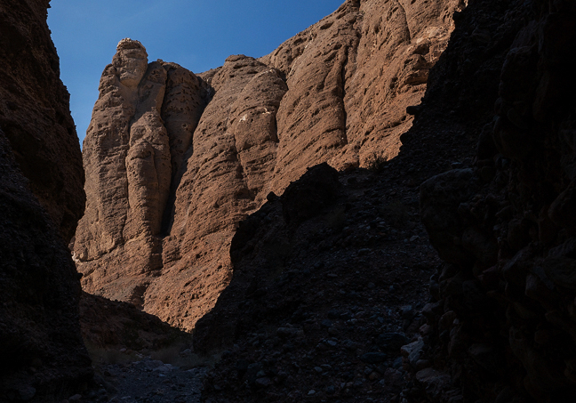
The Mummy, Mummy Canyon, Death Valley National Park, CA
This short canyon in the foothills of the Funeral Mountains is near the eastern entrance to the park along CA190. It features a towering rock mummy overlooking the canyon entrance. At the end of the trail, Jensen Natural Bridge connects the two sides of Mummy Canyon just above the pour over of a large dry fall.
©Rich Beckman
Jensen Natural Bridge, Mummy Canyon, Death Valley National Park, CA
This short canyon in the foothills of the Funeral Mountains is near the eastern entrance to the park along CA190. It features a towering rock mummy overlooking the canyon entrance. At the end of the trail, Jensen Natural Bridge connects the two sides of Mummy Canyon just above the pour over of a large dry fall.
©Rich Beckman