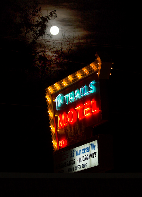
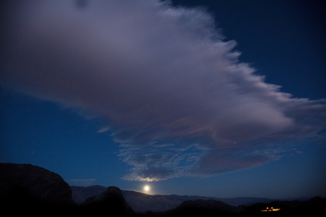
Full Moon Over the Trail Motel, Lone Pine, CA
Lone Pine is the closest town to Alabama Hills, an iconic western landscape that has been seen in more than 400 films and 100 television shows. On March 26, 1872, the Lone Pine earthquake destroyed most of the town and killed 27 of its 250 to 300 residents. Manzanar, seven miles to the north of Lone Pine was the first permanent relocation center (detention center) built after President Roosevelt ordered citizens of Japanese origin living along the Pacific to be relocated. It was home to more than 10,000 Japanese Americans during the war.
Today, Lone Pine is home to slightly more than 2,000 people and is a popular staging area for outdoor activities in the Alabama Hills and eastern Sierras.
©Rich Beckman
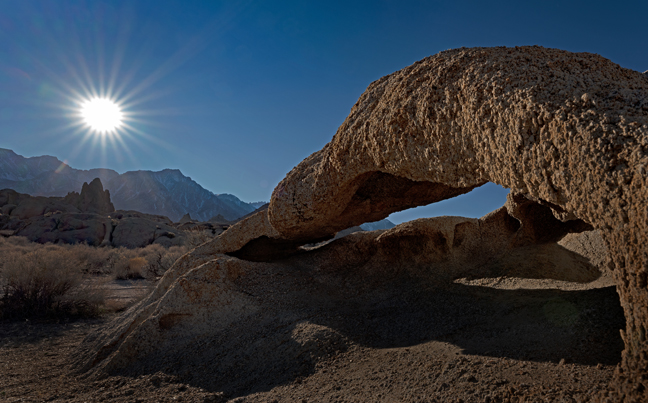
Whitney Portal Arch (N36°36.136 W118°09.345), Alabama Hills, Lone Pine, CA
It's a relatively easy 3/4 mile hike to the arch after crossing a foot bridge over Lone Pine Creek along Whitney Portal Road, although there is a bit of bouldering and a short traverse as you near the arch. It's visible throughout most of the hike, so it's easy to stay on course. Many folks have been disappointed upon reaching the arch as you have to be about 15 feet tall to actually see Mt. Whitney through the arch. The legend is that someone left an aluminum ladder at the site, but no one has seen it in years, so you have to be creative if you want to frame the mountains through the arch at first light.
©Rich Beckman
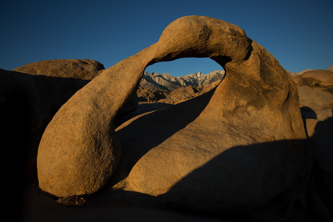
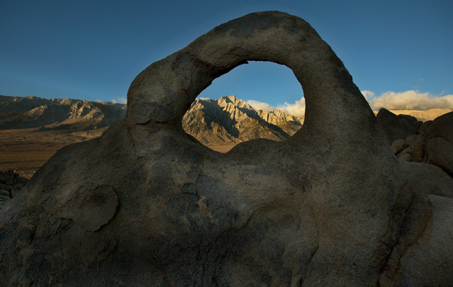
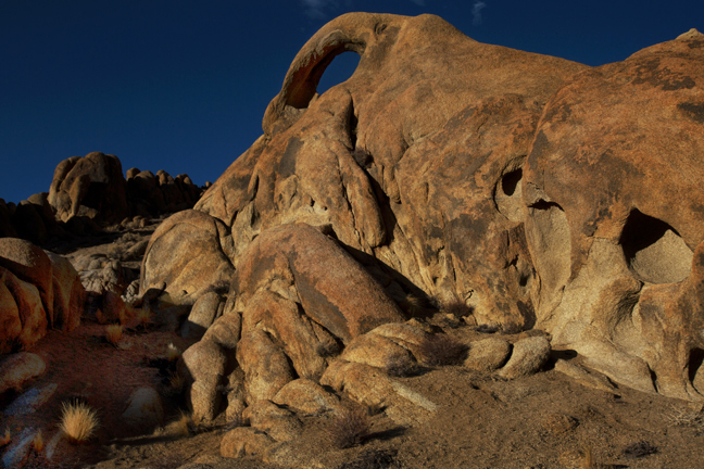
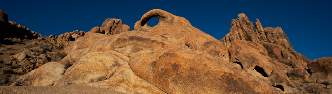
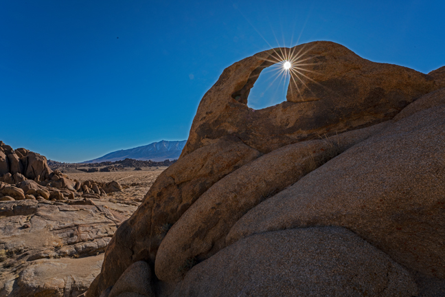
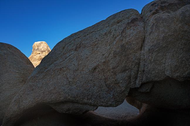
Mobius Arch (N36°36'811" W118°07'548"), Alabama Hills, Lone Pine, CA
Unlike Whitney Portal Arch, it's easy to frame the Sierras through either Mobius or Lathe Arches at sunrise. They are close together along Arch Trail which is clearly marked along Movie Road. You just have to share the vantage point with all of the other photographers who got up before dawn to make the short hike. Camping is permitted almost anywhere in Alabama Hills if you decide not to make the short pre-dawn drive from Lone Pine.
©Rich Beckman
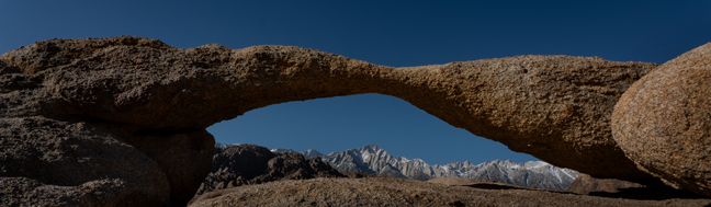
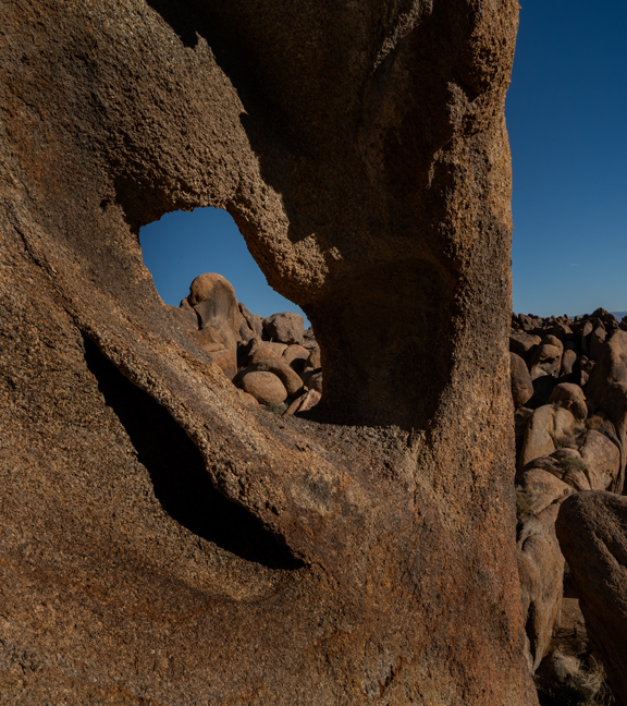
Lathe Arch (N36°36'804" W118°07'558"), Alabama Hills, Lone Pine, CA
Unlike Whitney Portal Arch, it's easy to frame the Sierra's through either Mobius or Lathe Arches at sunrise. They are close together along Arch Trail which is clearly marked along Movie Road. You just have to share the vantage point with all of the other photographers who got up before dawn to make the short hike. Camping is permitted almost anywhere in Alabama Hills if you decide not to make the short pre-dawn drive from Lone Pine.
©Rich Beckman
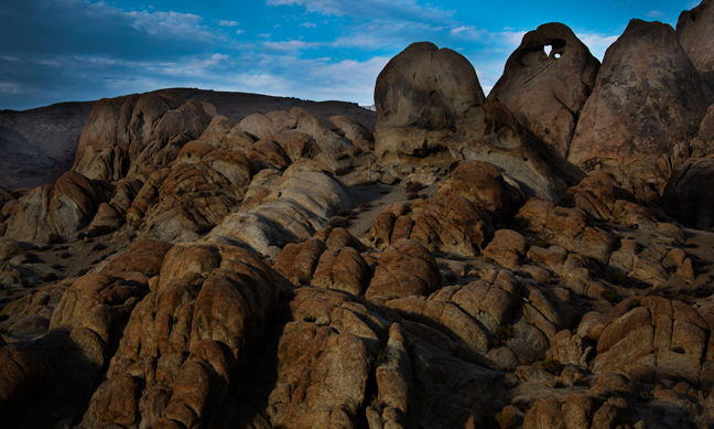
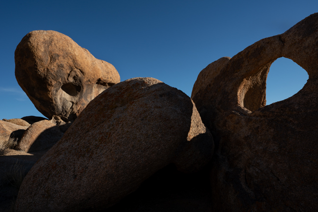
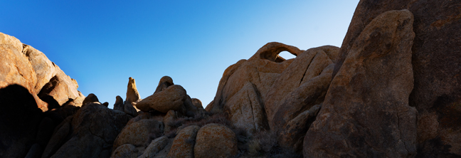
An unknown arch (N36°37'007" W118°07'522"), Alabama Hills, Lone Pine, CA
After photographing Mobius and Lathe Arches, we headed north in search of Space Case and Baseball Bat Arches. After a bit of aimless roaming, we came across this arch. It is not named Unknown Arch, we just couldn't figure out what arch it is. It is certainly named and known, so if you recognize it, please help us identify it. To add to our frustration, we didn't find either Space Case or Baseball Bat Arches in spite of having multiple concurring sources of coordinates.
©Rich Beckman
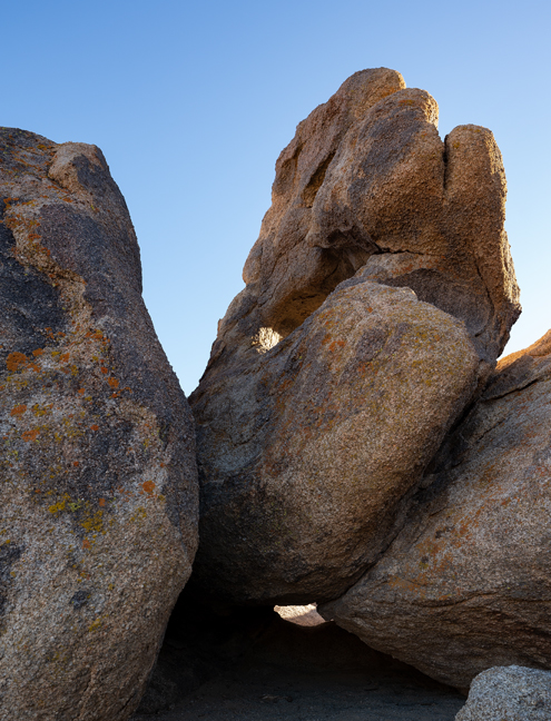
Heart Arch (N36°36'781" W118°07'387"), Alabama Hills, Lone Pine, CA
Heart Arch, which is more of a heart shaped hole in the back of a large rock than a true arch, can be seen from the Arch Trail Parking Lot along Movie Road. It is easy to reach by foot as it is about 700 feet due east of Lathe Arch.
©Rich Beckman
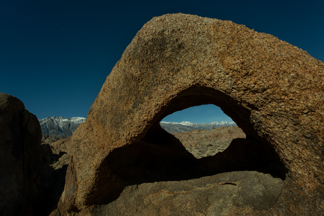
Eye of Alabama Arch (N36°36'969" W118°07"00") , Alabama Hills, Lone Pine, CA
The Eye of Alabama Arch is a short drive to the east and then north on Movie Road from the Arch Trail. The arches in Alabama Hills are not marked and there are no mileage markers. It's easiest to use the readily available GPS coordinates as there are more than 300 arches in the area.
©Rich Beckman
Unknown 2 Arch (N36°36'153" W118°06'934"), Alabama Hills, Lone Pine, CA
Unknown 2 Arch is in an area of Alabama Hills often referred to as the Beach Area and is best accessed with a 4-wheel drive vehicle as it requires crossing a deep, sandy, dry creek bed to reach the designated parking area and climbing a steep incline on the return.
©Rich Beckman
Surfer No. 3 Arch (N36°36'172" W118°06'433"), Alabama Hills, Lone Pine, CA
Surfer No. 3 Arch is also in the area of Alabama Hills often referred to as the Beach Area. It is about 300 ft. northwest of Unknown 2 Arch.
©Rich Beckman
Surfer No. 2 Arch (N36°36'191" W118°06'409"), Alabama Hills, Lone Pine, CA
Surfer No. 2 Arch is about 200 ft. northeast of Surfer No. 3 Arch. The formation seen through the arch is known as the Whale's Head.
©Rich Beckman
Hitching Post Arch (N36°36'182" W118°06'411"), Alabama Hills, Lone Pine, CA
Hitching Post Arch is at ground level between Surfer Arch No. 3 and Surfer Arch No. 2, just north of the parking area.
©Rich Beckman
Lifeguard Arch (N36°36'161" W118°06"508"), Alabama Hills, Lone Pine, CA
Approximately 600 feet due west of the parking area, across the two 4-wheel drive paths, is Lifeguard Arch.
©Rich Beckman
Old Tom Arch (N36°36'088" W118°06'852"), Alabama Hills, Lone Pine, CA
Old Tom and Brena Arches are the southern-most named arches in the Movie Road East Area.
©Rich Beckman
Brena Arch (N36°36'130" W118°07'080"), Alabama Hills, Lone Pine, CA
Old Tom and Brena Arches are the southern-most named arches in the Movie Road East Area.
©Rich Beckman
Grim Arch (N36°36'255" W118°07'142"), Alabama Hills, Lone Pine, CA
Grim Arch is at ground level on the west side of the dirt road, about 1,000 feet north of Brena Arch.
©Rich Beckman
Moon Rise, Alabama Hills, Lone Pine, CA
©Rich Beckman
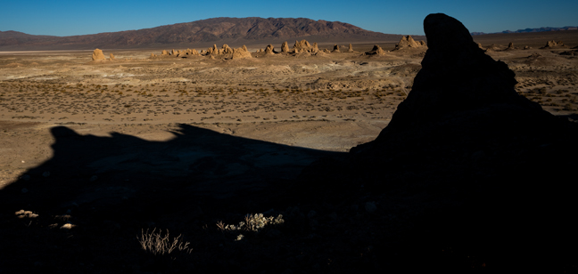
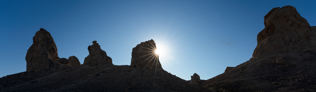
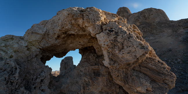
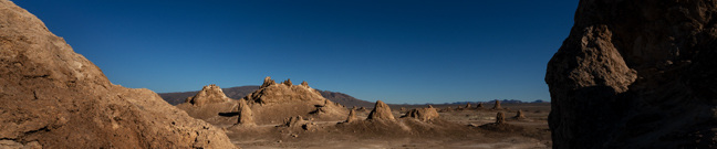
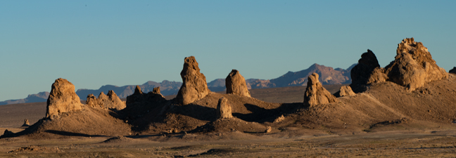
Trona Pinnacles, Mojave Desert, Trona, CA
About 100 miles southeast of Lone Pine, CA, in the Mojave Desert, are the Trona Pinnacles. They are located within an Area of Critical Environmental Concern as part of the California Desert National Conservation Lands on 3,800 protected acres of federal land managed by the Bureau of Land Management (BLM). They consist of more than 500 tufa spires (like those in Mono Lake) some as high as 140 ft. rising from the dry basin of Searles Lake, once part of a chain of interconnected Pleistocene lakes stretching from Death Valley to Mono Lake.
The pinnacles formed underwater and are divided by age and elevation into the northern, middle and southern groups. Once dubbed “Cathedral City,” the formations are classified into four general shapes: towers (taller than they are wide and at least 30 to 40 feet tall), tombstones (stubby and squat), ridges (massive, long sets of ruins) and cones (less than 10 feet tall).
©Rich Beckman
Trona Pinnacles, Mojave Desert, Trona, CA
About 100 miles southeast of Lone Pine, CA, in the Mojave Desert, are the Trona Pinnacles. They are located within an Area of Critical Environmental Concern as part of the California Desert National Conservation Lands on 3,800 protected acres of federal land managed by the Bureau of Land Management (BLM). They consist of more than 500 tufa spires, like those in Mono Lake, some as high as 140 ft. rising from the dry basin of Searles Lake, once part of a chain of interconnected Pleistocene lakes stretching from Death Valley to Mono Lake.
The pinnacles formed underwater and are divided by age and elevation into the northern, middle, and southern groups. Once dubbed “Cathedral City,” the formations are classified into four general shapes: towers (taller than they are wide and at least 30 to 40 feet tall), tombstones (stubby and squat), ridges (massive, long sets of ruins) and cones (less than 10 feet tall).
©Rich Beckman