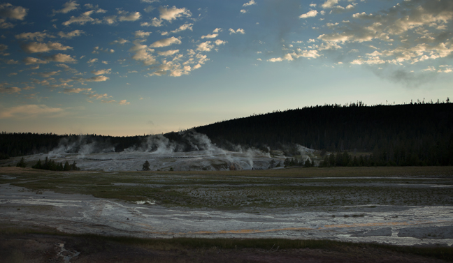
July 2017: Dawn, Upper Geyser Basin, Yellowstone National Park, WY
I avoid Yellowstone during the summer months, as the overpriced lodges are filled to capacity and pullouts are full of RVs, buses and endless waves of tourists, but we were passing by, had a few days before my next assignment and the wildflowers still outnumbered the tourists. Much of the Park’s wildlife had moved to higher elevations and the rest caused regular onlooker delays along the Park’s roads. National Parks were created for all people and charging $300+ per night for a simple room in a lodge in the Park is both ethically questionable and personally embarrassing, but it is just about the only realistic way to be in the Park for night skies and early morning light. However, I believe that National Parks should be available to all demographics and that Yellowstone lodges are much too expensive.
The summer of 2017 was especially challenging for visitors as Inspiration Point and Inspiration Point Road, the North Rim Trail between Grand View Point and Inspiration Point, between Cascade Falls and the Brink of Lower Falls and between Grand View Point and Inspiration Point were all closed. Uncle Tom's Point and Parking Area, Uncle Tom's Trail and the entire South Rim Trail were also closed. There were 30-minute delays and nightly closures on Grand Loop Road from Upper Terrace Loop Drive to Norris Junction.
Fortunately, Yellowstone is vast and even in summer I find isolation in the early mornings, late evenings and during the night. I can join the pre-dawn community of wolf watchers at Alum Creek and be the only person watching Old Faithful by moonlight at 1:30 a.m. July is also the time for wildflowers in Yellowstone and most hiking trails are practically abandoned at sunrise. And, it's Yellowstone and no amount of aggravation can make it unbearable.
©Rich Beckman
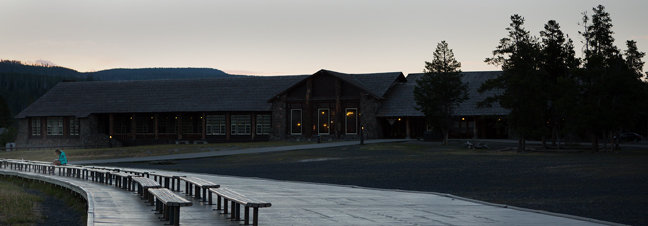
July 2017: Waiting for Old Faithful, Upper Geyser Basin, Yellowstone National Park, WY
If you want to avoid the thousands of people who gather every 90 minutes to watch Old Faithful erupt on a July day, show up at 6 a.m. and enjoy the solitude.
©Rich Beckman
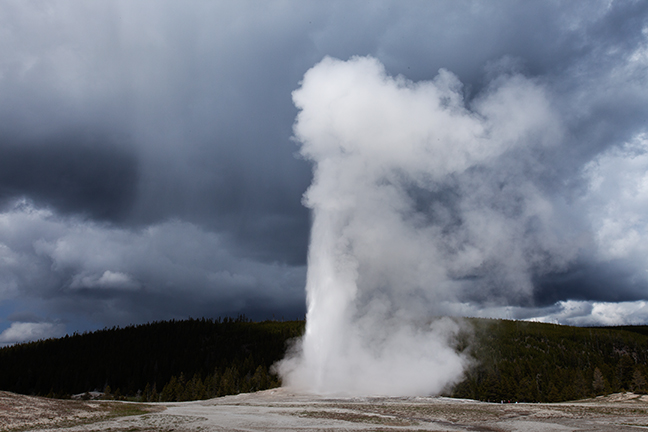
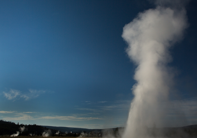
May 2016: Old Faithful, Yellowstone National Park, WY
The predictability of Old Faithful eruptions can be attributed to the fact that it is not connected to any other thermal features in the Upper Geyser Basin. It currently erupts approximately every 91 minutes, although the length of the previous eruption impacts that. The first recorded observation of the geyser was on the afternoon of September 18, 1870 by members of the Washburn-Langford-Doane Expedition, who also named the geyser.
During an eruption, the water temperature at the vent has been measured at 204°F and the temperature of the steam above 350°F. During the late 1800's, Old Faithful was used as a laundry. Garments placed in the crater were said to be thoroughly washed when ejected during an eruption.
©Rich Beckman
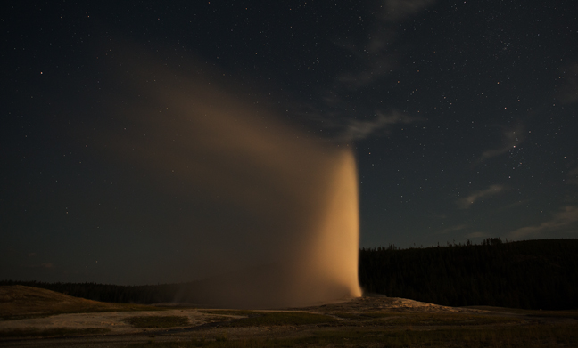
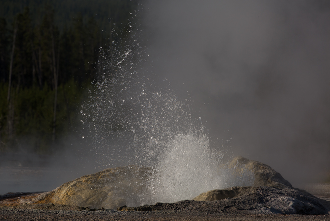
July 2017: Old Faithful, Waning Gibbous, Yellowstone National Park, WY
If you want to be the only person watching Old Faithful, just show up at 1:30 a.m. and enjoy the eruption illuminated by a large waning gibbous moon.
©Rich Beckman
July 2017: Comet Geyser, Upper Geyser Basin, Yellowstone National Park, WY
Comet Geyser sits in the middle of, and has the largest cone of the Daisy Group. It erupts almost continuously, surging to a height of 6 feet. These constant eruptions result in it having a large sinter cone. The Daisy Group also includes Daisy and Splendid geysers and Brilliant Pool.
©Rich Beckman
July 2017: Daisy Geyser, Upper Geyser Basin, Yellowstone National Park, WY
Daisy erupts every 110 to 240 minutes for a period of 3 to 5 minutes and is one of the most predictable geysers in the park. It erupts at an angle to the ground and reaches a height of 75 feet. The interval between eruptions can be altered by an eruption of nearby Splendid Geyser.
©Rich Beckman
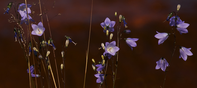
July 2017: Harebells, Upper Geyser Basin, Yellowstone National Park, WY
Did the Harebell loose her girdle
To the lover Bee
Would the Bee the Harebell hallow
Much as formerly?
Did the "Paradise"—persuaded—
Yield her moat of pearl—
Would the Eden be an Eden,
Or the Earl—an Earl?
by: Emily Dickinson
©Rich Beckman
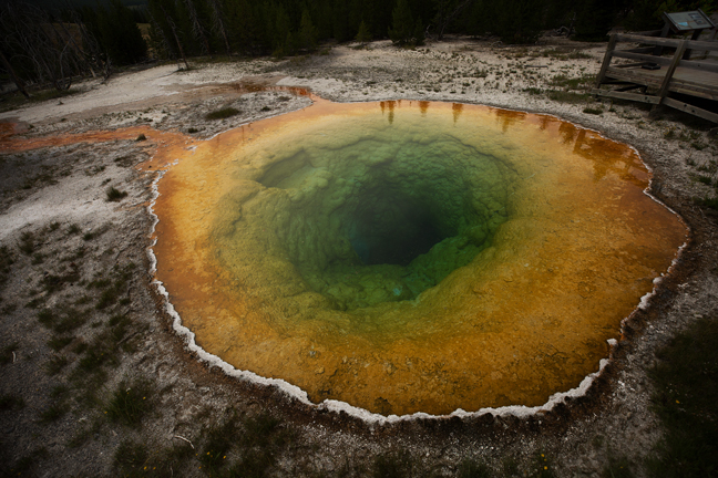
July 2017: Morning Glory Pool, Upper Geyser Basin, Yellowstone National Park, WY
The original name of Morning Glory Pool was Convolutus, after the Latin word for the morning glory flower. The distinct color of the pool is due to bacteria which inhabit the water. Over the years however, people have thrown tons of coins, trash, rocks, logs and other debris into the pool that became embedded in the sides and vent of the spring, affecting water circulation and accelerating the loss of thermal energy.
Through the years Morning Glory's appearance has changed as its temperature dropped. Orange and yellow bacteria that formerly colored only the periphery of the spring now spread toward its center. The delicate blue water is created by thermophilic bacteria, which thrive in the pool’s searing heat. The trash has blocked thermal vents and reduced the heat of the pool, allowing other bacteria to begin working their way in at the edges, creating a red and yellow ring around the pure blue center.
©Rich Beckman
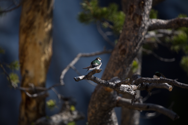
May 2016: Yellowstone National Park, WY
A Violet-green Swallow perches on a branch in front of Gibbon Falls. Similar to other swallows, they are specialized aerial insectivores, catching and eating their prey while in flight.
©Rich Beckman
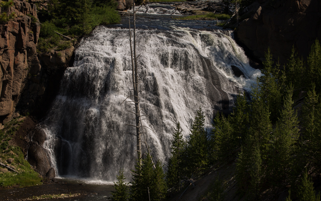
July 2017: Gibbon Falls, Yellowstone National Park, WY
The 84 ft. high Gibbon Falls is a popular stop between Norris Geyser Basin and Madison Junction, 4.7 miles upstream from the confluence of the Gibbon and Firehole Rivers on the Grand Loop Road. It was discovered in 1872 by William Henry Jackson and John Merle Coulter during the second Hayden survey.
©Rich Beckman
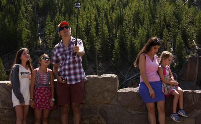
July 2017: Selfie Stick, Gibbon Falls, Gibbon River, Yellowstone National Park, WY
It looks likes if you misbehave you don't get to be in the selfie stick family portrait in front of Gibbon Falls. I actually have no idea what's really going on here, but it's funny nonetheless.
©Rich Beckman
May 2016: Conifers, Gibbon Falls, Yellowstone National Park, WY
The 84 ft. high Gibbon Falls is a popular stop between Norris Geyser Basin and Madison Junction, 4.7 miles upstream from the confluence of the Gibbon and Firehole Rivers on the Grand Loop Road. It was discovered in 1872 by William Henry Jackson and John Merle Coulter during the second Hayden survey.
©Rich Beckman
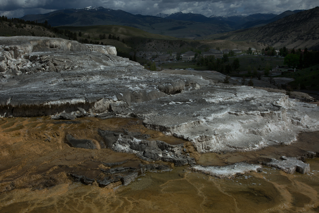
May 2016: Mammoth Hot Springs, Yellowstone National Park, WY
©Rich Beckman
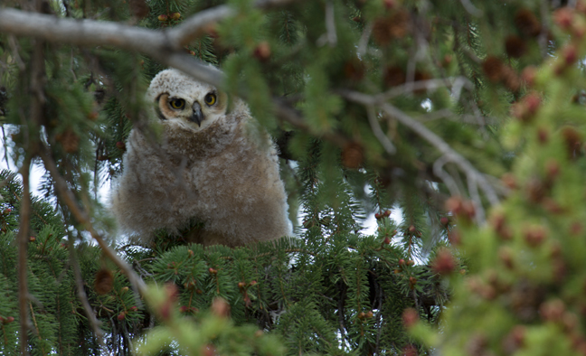
May 2016: Great Horned Owl Chick, Mammoth Hot Springs, Yellowstone National Park, WY
This nest, adjacent to one of the staff quarters near the visitor center, has been active for many years. In 2016, there were two chicks. The Great Horned Owl is one of the earliest nesting raptors and by May the chicks were large enough to be mobile, though still flightless.
©Rich Beckman
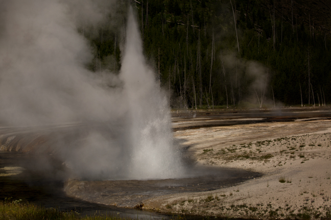
July 2017: Spouter Geyser, Black Sand Basin, Yellowstone National Park, WY
Spouter Geyser erupts almost constantly, with only a one to two hour interval, reaching a height 5-7 feet . It is a fountain-type geyser and erupts from a splashing, blue pool of water to a height of five to seven feet. The crater drains after each eruption and the overflow discharges into Opalescent Pool.
©Rich Beckman
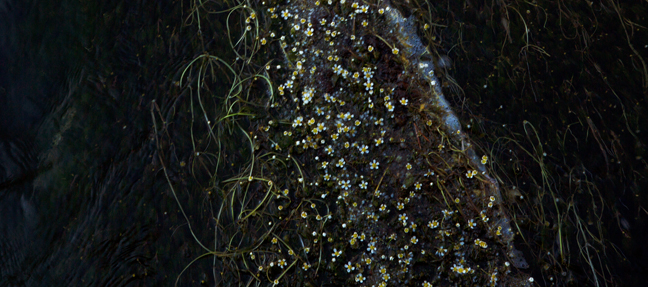
July 2017: Common Water-Crowfoot, Black Sand Basin, Yellowstone National Park, WY
Ranunculus aquatilis (common water-crowfoot, white water-crowfoot) is an aquatic plant that grows in mats on the surface of water. It has branching underwater leaves and toothed floater leaves that prop up the white flowers above the surface of the water.
©Rich Beckman
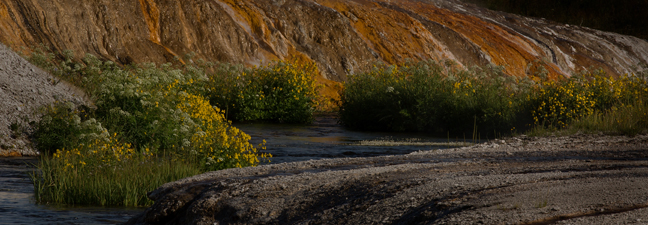
July 2017: Iron Spring Creek, Black Sand Basin, Yellowstone National Park, WY
Iron Spring Creek is a tributary of the Little Firehole River that enters the stream a few hundred yards upstream of the confluence of the Little Firehole and Firehole Rivers. The stream starts on a plateau and cascades down to the Biscuit Basin area.
©Rich Beckman
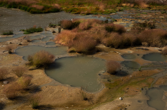
July 2017: Mud Pots, Yellowstone National Park, WY
©Rich Beckman
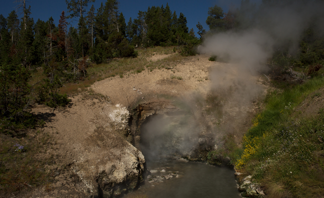
July 2017: Dragon's Mouth, Yellowstone National Park, WY
Dragon's Mouth is a turbulent hot spring with a cavernous mouth. As hot water rises to the surface, hydrogen sulfide, carbon dioxide and water vapor gases expand creating a pressure explosion in the cavern. The resulting activity resembles a belching, steaming dragon. The Washburn Expedition and the Hayden Survey discovered the area during the early 1870s.
©Rich Beckman
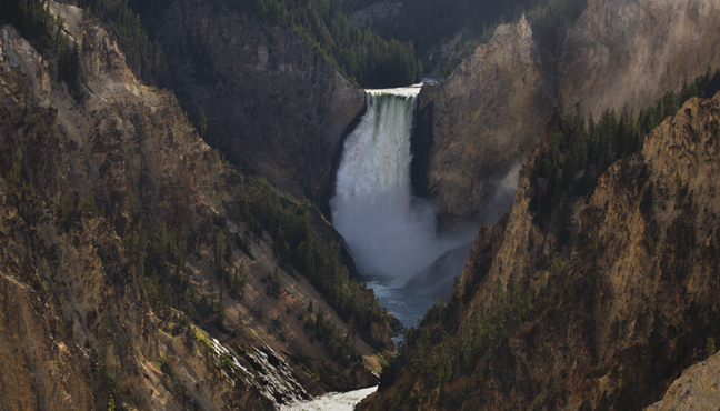
July 2017: Lower Falls, Yellowstone River, Yellowstone National Park, WY
Lower Yellowstone Falls is the largest volume waterfall in the Rocky Mountains. The Falls is 308 feet high, nearly twice the height of Niagara Falls, but the Yellowstone River is only 70 feet wide at the point at which it goes over the lower falls.
©Rich Beckman
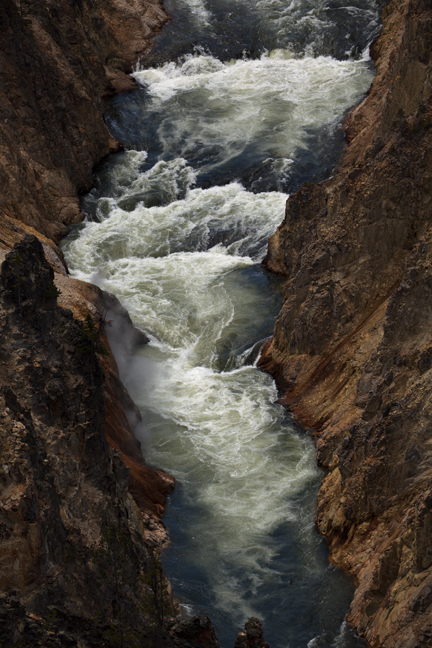
July 2017: Yellowstone River, Grand Canyon of Yellowstone, WY
The Canyon is 20 miles long, up to 4,000-feet wide and 1,200-feet deep in places. The region was covered by a massive lava flow more than 600,000 years ago. Thermal features developed making the rock susceptible to erosion and discolored iron compounds in the rock cause the different colors in the canyon walls. The present day canyon was formed between 10,000 and 14,000 years ago and earthquakes, erosion, water and wind continue to affect its composition. The yellow stained rocks along the canyon walls are how the park got its name.
©Rich Beckman
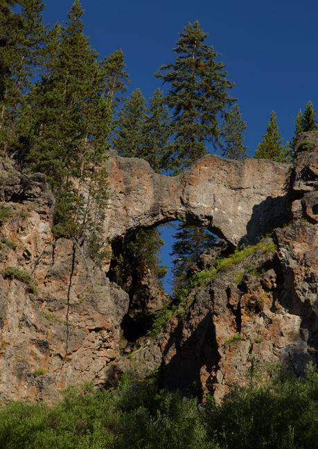
July 2017: Natural Bridge, Bridge Creek, Yellowstone National Park, WY
Bridge Creek starts on the upper slopes of Elephant Back Mountain and flows down a densely wooded valley towards Yellowstone Lake, at one point cascading over the edge of a rhyolite plateau, where the waters have carved a small natural bridge, 30 feet across, topped by a narrow span of dark-colored, lichen-covered rock, on which grows a lone pine tree.
©Rich Beckman
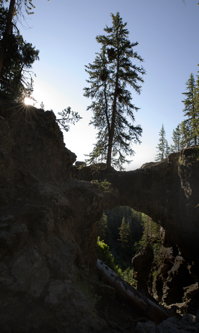
July 2017: Sunrise, Natural Bridge, Bridge Creek, Yellowstone National Park, WY
Bridge Creek starts on the upper slopes of Elephant Back Mountain and flows down a densely wooded valley towards Yellowstone Lake, at one point cascading over the edge of a rhyolite plateau, where the waters have carved a small natural bridge, 30 feet across, topped by a narrow span of dark-colored, lichen-covered rock, on which grows a lone pine tree.
©Rich Beckman
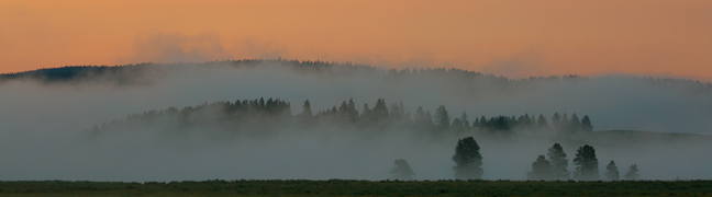
July 2017: Morning Fog, Yellowstone River, Yellowstone National Park, WY
Morning fog between Otter and Alum Creeks.
©Rich Beckman
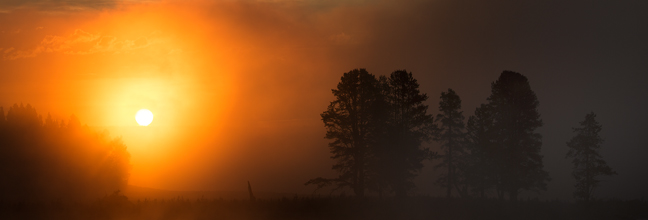
July 2017: Sunrise, Yellowstone River, Yellowstone National Park, WY
On a foggy morning along the Yellowstone River just past Otter Creek.
©Rich Beckman
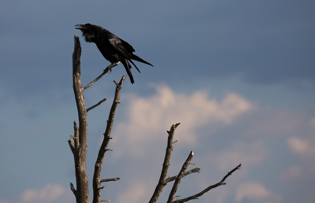
July 2017: Raven, Alum Creek, Yellowstone National Park, WY
©Rich Beckman
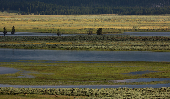
July 2017: Bull Elk, Alum Creek, Yellowstone National Park, WY
©Rich Beckman
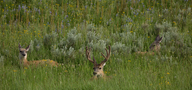
July 2017: Deer in Wildflowers, South Rim Drive, Yellowstone National Park, WY
©Rich Beckman
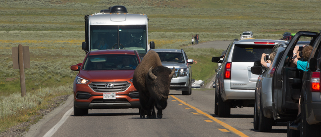
July 2017: Summer Traffic, Between Alum Creek and Canyon Village, Yellowstone National Park, WY
©Rich Beckman