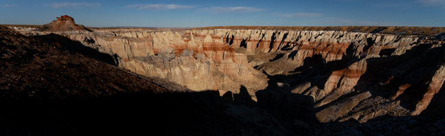
Coal Mine Canyon, AZ
The four-mile long Coal Mine Canyon features a variety of colorful spires, hoodoos, cliffs and fins and is composed of thin layers of soft Dakota Sandstone on top of thicker layers of Entrada Dakota Sandstone. The mesa and canyon are named on account of the thin, low grade deposits of coal that are found scattered across the area, and are prominently visible in parts of the upper canyon. There is a path to the canyon floor, about 400 feet below, just east of the picnic tables, with a steep descent bordered by rope railings.
The Canyon rim is on Navajo land and the Canyon floor is on Hopi land. The area is unposted, but some literature says that you need a Navajo permit to visit the rim and a Hopi guide to descend into the Canyon. I've never seen any permits or guides, but both the Navajo and the Hopi are sovereign nations with their own legal systems, so it is best to follow their regulations.
Access to the canyon is off of Hwy 264 between mile marker 337 and 338.
©Rich Beckman
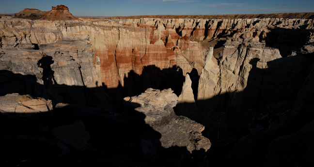
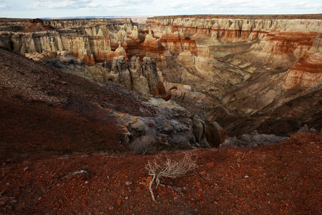
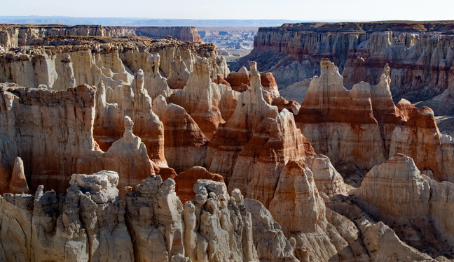
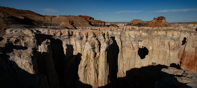
White Mesa Arch (12S 502219 4036505, 85 x 55 feet), Navajo Nation, AZ
White Mesa Arch is located at the eastern edge of the mesa within the Navajo Nation. The Navajo Nation includes parts of Utah, New Mexico and Arizona and covers more than 27,000 square miles. If it were a state it would be the 41st largest state in the country, larger than Maryland, Vermont and New Hampshire combined. Access is restricted to persons of Navajo lineage and permit holders.
©Rich Beckman
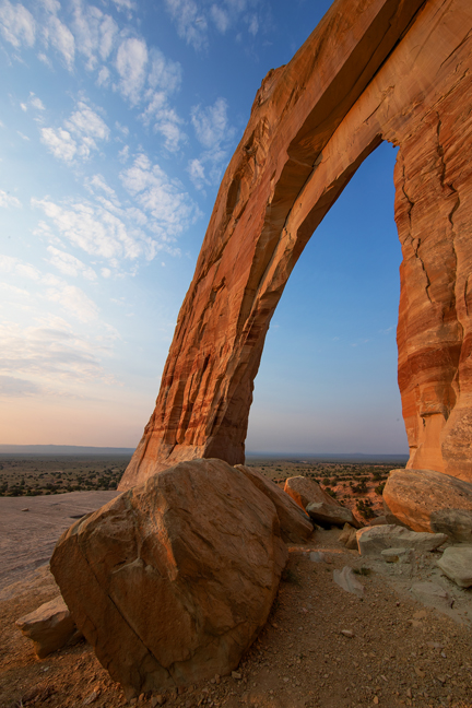
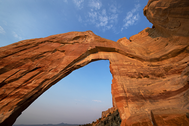
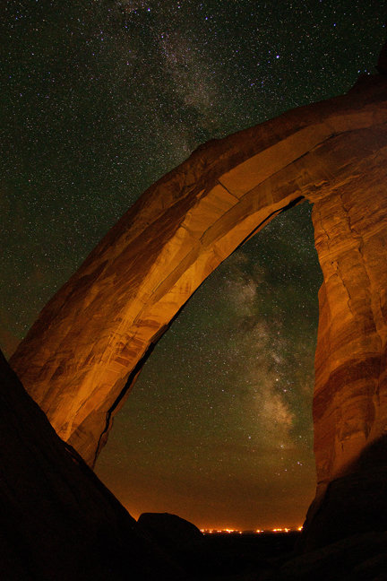
White Mesa Arch (12S 502219 4036505, 85 x 55 feet), Navajo Nation, AZ
White Mesa Arch is located at the eastern edge of the mesa within the Navajo Nation. The Navajo Nation includes parts of Utah, New Mexico and Arizona and covers more than 27,000 square miles. If it were a state it would be the 41st largest state in the country, larger than Maryland, Vermont and New Hampshire combined. Access is restricted to persons of Navajo lineage and permit holders.
Unfortunately, there is now a Native village with extensive light pollution directly southwest of the arch, exactly below where the core of the Milky Way aligned with the arch. Even in the middle of the Navajo Nation, completely dark skies are challenging to find.
©Rich Beckman
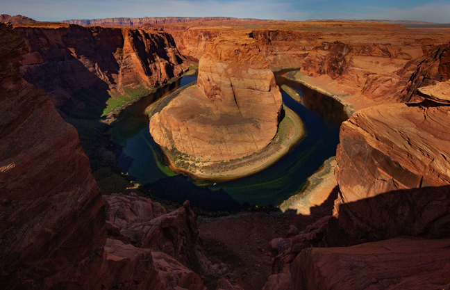
Horseshoe Bend, AZ
Horseshoe Bend is a horseshoe-shaped incised meander of the Colorado River five miles downstream from the Glen Canyon Dam and Lake Powell within Glen Canyon National Recreation Area. It is accessible via a roundtrip 1.5-mile sandy hike from a parking area just off U.S. Route 89. The overlook is 4,200 feet above sea level, and the Colorado River is at 3,200 feet above sea level, thus resulting in a 1,000-foot drop.
©Rich Beckman
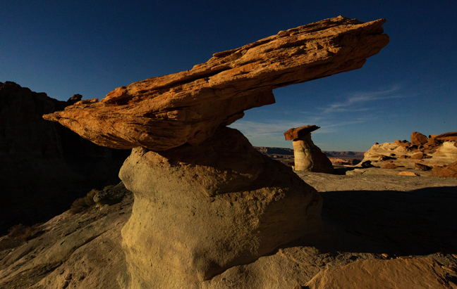
Stud Horse Point, AZ
Stud Horse Point is a narrow promontory at the end of a broad mesa spanning the Arizona/Utah state line about seven miles west of Page, AZ. Within a ravine along the four-wheel drive approach road are several large hoodoos and a view overlooking Lake Powell.
©Rich Beckman
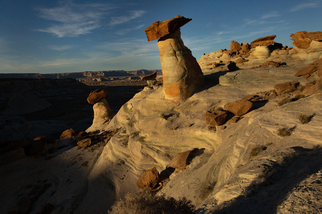
Stud Horse Point, AZ
Stud Horse Point is a narrow promontory at the end of a broad mesa spanning the Arizona/Utah state line about seven miles west of Page, AZ. Within a ravine along the four-wheel drive approach road are several large hoodoos and a view overlooking Lake Powell.
©Rich Beckman
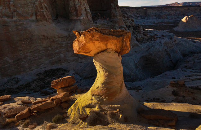
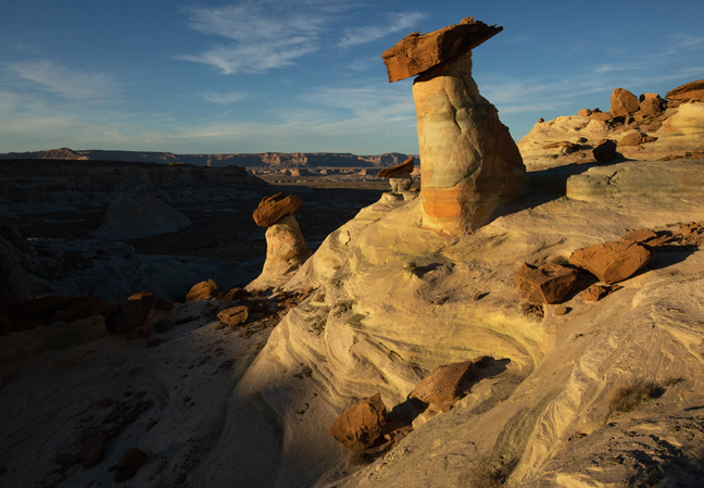
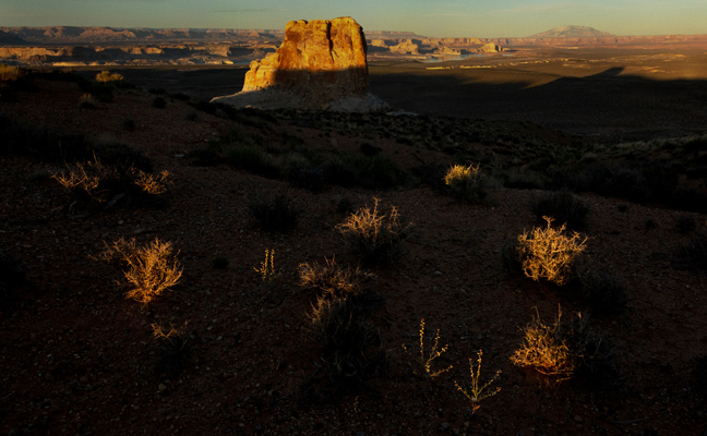
Stud Horse Point, AZ
Stud Horse Point is a narrow promontory at the end of a broad mesa spanning the Arizona/Utah state line about seven miles west of Page, AZ. Within a ravine along the four-wheel drive approach road are several large hoodoos and a view overlooking Lake Powell.
©Rich Beckman
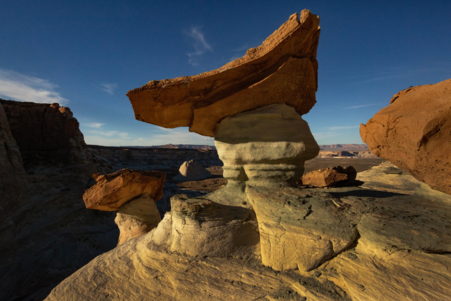
Stud Horse Point, AZ
Stud Horse Point is a narrow promontory at the end of a broad mesa spanning the Arizona/Utah state line about seven miles west of Page, AZ. Within a ravine along the four-wheel drive approach road are several large hoodoos and a view overlooking Lake Powell.
©Rich Beckman
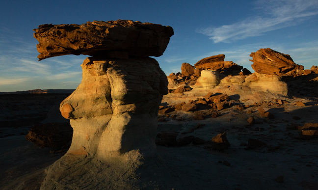
Stud Horse Point, AZ
Stud Horse Point is a narrow promontory at the end of a broad mesa spanning the Arizona/Utah state line about seven miles west of Page, AZ. Within a ravine along the four-wheel drive approach road are several large hoodoos and a view overlooking Lake Powell.
©Rich Beckman
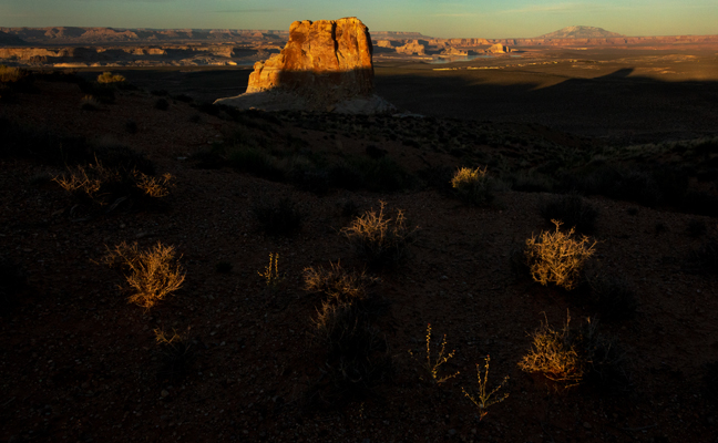
Stud Horse Point, AZ
Stud Horse Point is a narrow promontory at the end of a broad mesa spanning the Arizona/Utah state line about seven miles west of Page, AZ. Within a ravine along the four-wheel drive approach road are several large hoodoos and a view overlooking Lake Powell.
©Rich Beckman