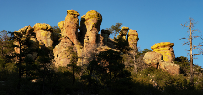
Chiricahua National Monument, AZ, June 2020
After three months of Zoom meetings, early morning desert hikes and workouts in our home gym, having the freezer, air conditioner, entry gate, pool and irrigation systems all suffer through their own pandemics and watching the Bighorn fire savage the Santa Catalina Mountains out our living room windows, it was time for a break.
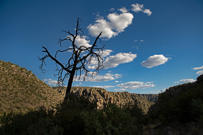
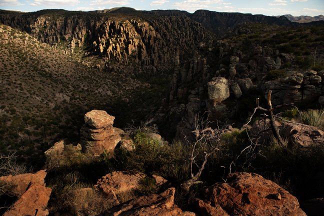
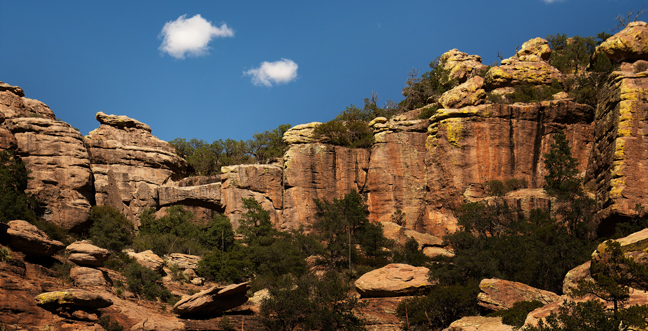
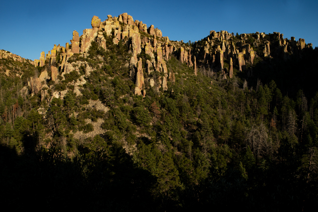
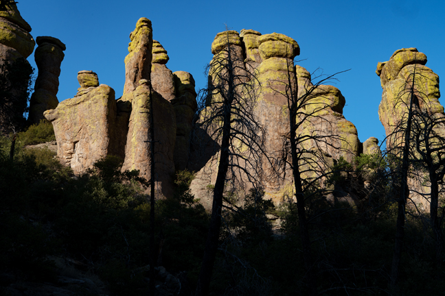
The Chiricahua Mountains in southeastern Arizona are part of the Coronado National Forest. Chiricahua Peak rises 9,759 feet above sea level and approximately 6,000 feet above the surrounding valleys. They were formed by volcanic eruptions and intrusions 25-35 million years ago. The last major eruption deposited 2,000 feet of volcanic ash which fused into welded rhyolite tuff. Subsequent erosion created ridges covered in stone spires, hoodoos and columns that rise up out of the forest, much of it still recovering from the massive Horseshoe Two Fire that consumed more than 222,000 acres in the summer of 2011.
The Mexican American War began in 1846 and ended in 1848. The Treaty of Guadalupe-Hidalgo and subsequent Gadsden Purchase officially made the Southwest a part of the United States as it is today. In the Treaty of Guadalupe-Hidalgo, Mexico agreed to surrender all claims to Texas and accept the Rio Grande as the boundary and later agreed to sell its New Mexico and Upper California territories to the U.S. for the price of $15 million. The treaty resulted in Mexico losing half its territory and the U.S. doubling in size. On February 24, 1863 Congress passed the Arizona Organic Act, which split off the western portion of the then New Mexico Territory as the Arizona Territory. Forty nine years later on February 14, 1912, Arizona achieved statehood, the last of the 48 contiguous states to be added.
Until the late 19th century, this was still Apache country. Chiefs Geronimo, Cochise, Naiche, Mangus and more than 1,500 Native Americans inhabited the region as their ancestors had for more than 400 years. In 1875, United States military forced the removal of more than 1600 Yavapai and Apache from the Rio Verde Indian Reserve and its several thousand acres of treaty lands promised to them by the government. They were forced to trek more than 180 treacherous miles to the Indian Agency Camp at San Carlos where they were interned for 25 years while white settlers took over their land. They were then sent by train into military confinement in Fort Pickens, FL and, subsequently, Ft. Sill, Oklahoma.
The Chiricahua National Monument was established in 1924 and is best known for the Heart of Rocks Loop Area, a dense region of hoodoos, pinnacles and balanced rocks miles in distance and thousands of feet in elevation from the nearest trailhead. Although the loop features a number of named and signed rock formations, the designations are really unnecessary distractions. I’d much prefer they remove the signs and let visitors find their own associations. They simply get in the way for photographers and limit the imagination.
There is a campground in the National Monument, but it and the Visitor Center were closed during our June 2020 visit due to the Covid-19 virus. We opted for the closest unshared Airbnb, which was almost an hour away from the main Echo Canyon Trailhead. This and the hazy skies from the various Arizona wildfires made night sky photography infeasible. Or perhaps, that was just my excuse for not venturing out at midnight after daily five-eight mile hikes at 6000-7000+ ft. elevations with 1000-2000+ feet in elevation gain in Arizona’s 90 degree temperatures.
Photographing gray rhyolite rock formations is more challenging than photographing the beautiful red Navajo Sandstone features of southern Utah and northern Arizona, but just as much fun. You have to be patient and wait on the light and work hard to find patterns of shadow that make for interesting compositions. It was a fun way to observe the summer solstice and a pleasant diversion from everything that is wrong in the world these days.
©Rich Beckman
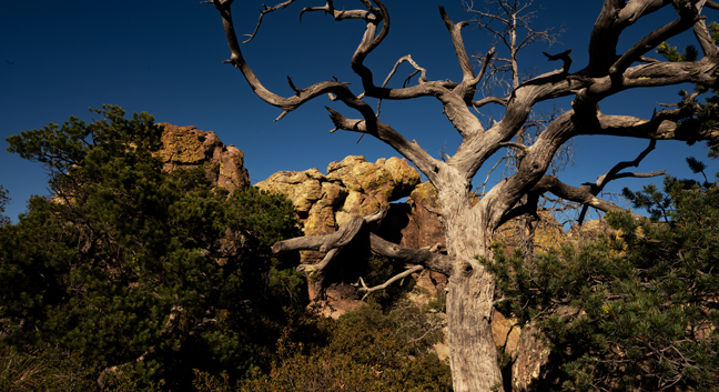
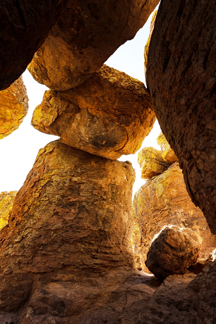
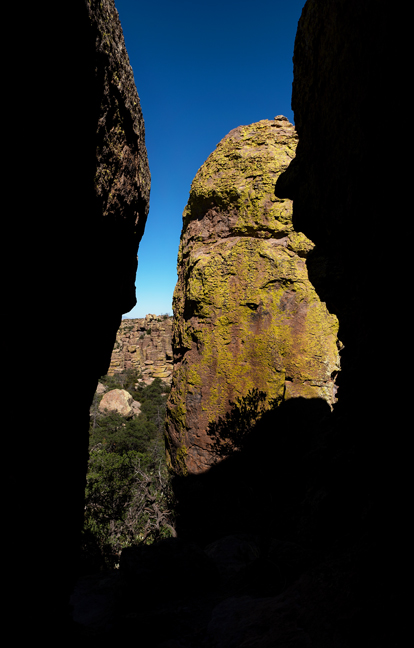
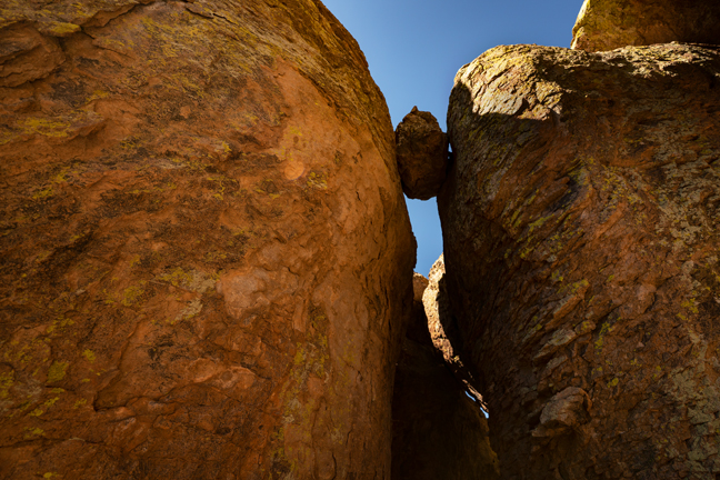
Echo Canyon Loop, Chiricahua National Monument, AZ, June 2020
The 3.6 mile hike around Echo Canyon encompasses three trails. From the Echo Canyon Parking Area, it’s easiest to hike the loop counterclockwise, heading south on Echo Canyon Trail, then east on Hailstone Trail before climbing back up to the trailhead on the Ed Riggs Trail. Almost immediately after leaving the first junction and heading down Echo Canyon Trail, you’ll encounter the grottoes, a complex of passageways and giant boulders that invites exploration. After a bit more than a mile, you’ll come to the junction of The Hailstone Trail that skirts the south-facing wall of Rhyolite Canyon for about a mile. The final leg of the trail is all uphill along the Ed Riggs Trail and features numerous impressive rock features and vistas of spires and hoodoos that are best viewed in the late afternoon.
©Rich Beckman
Natural Bridge Trail, Chiricahua National Monument, AZ, June 2020
The Natural Bridge Trail is a 4.8 mile moderate out and back hike with 1000+ ft. of elevation gain that begins along Bonita Canyon Drive about a half a mile past the campground. During early Spring and monsoon season, there might be a river crossing required. The trails lead to a rock feature referred to as Chiricahua Natural Bridge, but it is not a natural bridge as the opening was not formed by the flow of water. In fact, it was formed when a block of rock fell and became wedged between two rock towers that subsequent weathering has made continuous. Technically, it may not be an arch at all as it was not formed by erosion. The trail goes to an overlook, not to the base or top of the feature. Both can be reached with some challenging bushwhacking and scrambling.
©Rich Beckman
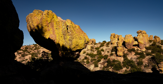
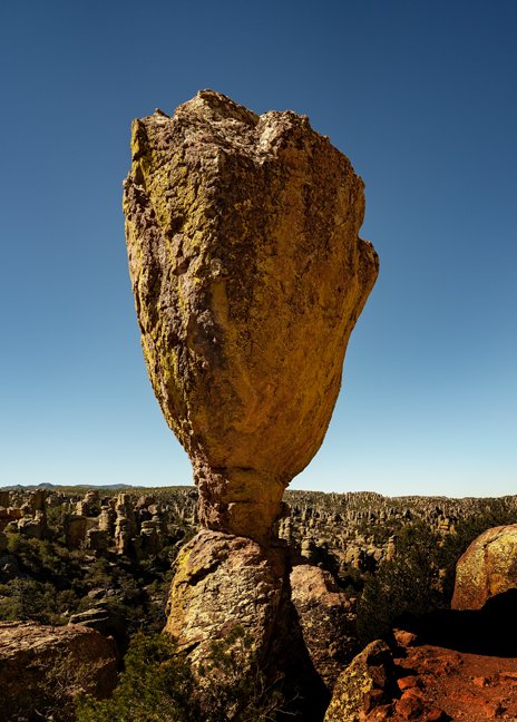
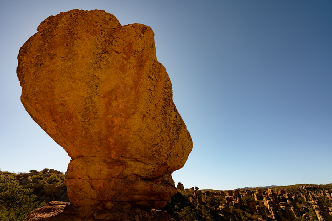
Heart of the Rocks, Chiricahua National Monument, AZ, June 2020
The eight mile out and back hike to the Heart of Rocks from Echo Canyon begins by heading south and downhill along the Ed Riggs Trail before a long and steady climb up to 7,100 ft. on Mushroom Rock Trail. This then intersects with the mostly level Big Balanced Rock Trail that ends at the trailhead to the mile-long Heart of Rocks Loop about a mile later. The National Park Service has posted signs pointing to various named features along the Heart of Rocks trail, which is disappointing within a National Monument and distracts from the experience. Like the loop trail around Echo Canyon, this hike also ends with the uphill Ed Riggs Trail back to the trailhead. In the summer heat, this is an exhausting hike and each of us came close to draining our three-liter hydration packs.
©Rich Beckman
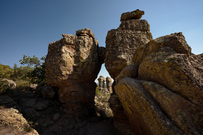
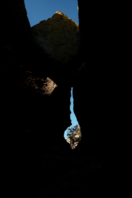
Punch and Judy Arch, 12S-658558-3541312, Heart of the Rocks, Chiricahua National Monument, AZ, June 2020
The eight mile out and back hike to the Heart of Rocks from Echo Canyon begins by heading south and downhill along the Ed Riggs Trail before a long and steady climb up to 7,100 ft. on Mushroom Rock Trail. This then intersects with the mostly level Big Balanced Rock Trail that ends at the trailhead to the mile-long Heart of Rocks Loop about a mile later. The National Park Service has posted signs pointing to various named features along the Heart of Rocks trail, which is disappointing within a National Monument and distracts from the experience. Like the loop trail around Echo Canyon, this hike also ends with the uphill Ed Riggs Trail back to the trailhead. In the summer heat, this is an exhausting hike and each of us came close to draining our three-liter hydration packs.
©Rich Beckman

Heart of the Rocks, Chiricahua National Monument, AZ, June 2020
The eight mile out and back hike to the Heart of Rocks from Echo Canyon begins by heading south and downhill along the Ed Riggs Trail before a long and steady climb up to 7,100 ft. on Mushroom Rock Trail. This then intersects with the mostly level Big Balanced Rock Trail that ends at the trailhead to the mile-long Heart of Rocks Loop about a mile later. The National Park Service has posted signs pointing to various named features along the Heart of Rocks trail, which is disappointing within a National Monument and distracts from the experience. Like the loop trail around Echo Canyon, this hike also ends with the uphill Ed Riggs Trail back to the trailhead. In the summer heat, this is an exhausting hike and each of us came close to draining our three-liter hydration packs.
©Rich Beckman
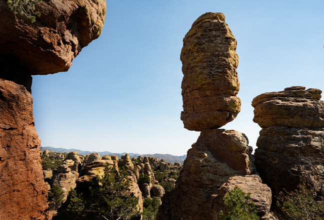