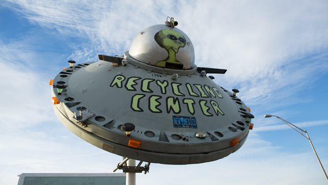

Recycling Center, Socorro, NM
More than 10,000 sandhill cranes and 20,000 Ross's and snow geese winter at the Bosque del Apache National Wildlife Refuge. The Refuge is located a few miles south of San Antonio, New Mexico along the Rio Grande River. Twenty-eight miles to the southeast is Trinity Site, where the first atomic bomb was detonated at 5:29 a.m. on July 16, 1945 as part of the Manhattan Project.
Eight miles to the north is the larger town of Socorro, site of one of the best-documented cases of a suspected UFO landing. On the afternoon of April 24, 1964, City of Socorro Police Officer Lonnie Zamora (1933-2009) viewed the craft, its passengers, indentations made by its landing gear and smoldering greasewood plants at the site. Today, 50 miles to the west of Socorro is the Karl G. Jansky Very Large Array, one of the world's premier astronomical radio observatories, although it is (purportedly) not used to assist in the search for extra-terrestrials.
©Rich Beckman
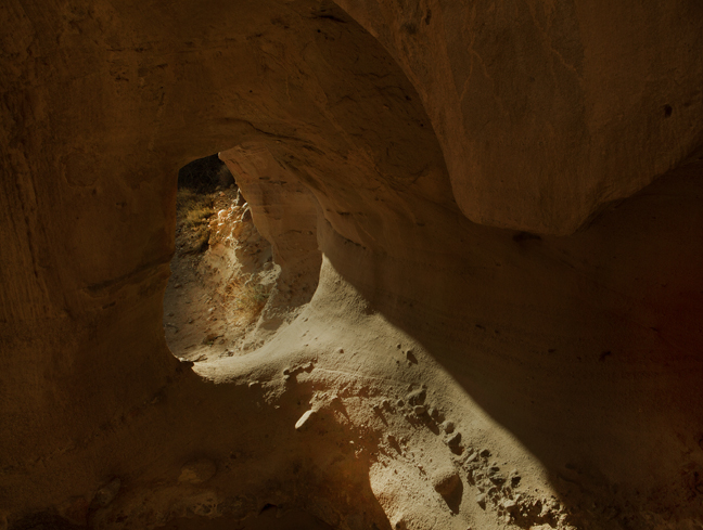

Natural Arch, Canyon Trail, Bosque del Apache National Wildlife Refuge
The 2.2-mile Canyon Trail traverses the northern tip of the Chihuahuan Desert. After passing through an arroyo populated with fourwing saltbush, you enter the mouth of Solitude Canyon and the Indian Wells Wilderness Area. Prickly pear and tree cholla are common along the sandy trail. On sunny days, gopher, glossy, desert king and diamondback (rattle) snakes might be seen along the trail and black-tailed jackrabbits and cottontails find shade under the bushes and rocks.
©Rich Beckman
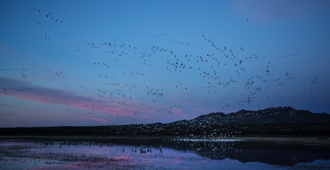

Dawn, North Pond, Chupadera Mountains, Bosque del Apache National Wildlife Refuge
The Refuge boundary is five miles south of the intersection of New Mexico State Road 1 and U.S. Route 380 in San Antonio. Immediately after entering the refuge are North and South ponds. North Pond (formally known as the Wetland Management Unit 3 pullout) is a great viewing area at sunrise and sunset. (1/6)
©Rich Beckman
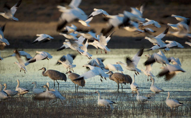

Dawn, North Pond, Chupadera Mountains, Bosque del Apache National Wildlife Refuge
The Refuge boundary is five miles south of the intersection of New Mexico State Road 1 and U.S. Route 380 in San Antonio. Immediately after entering the refuge are North and South ponds. North Pond (formally known as the Wetland Management Unit 3 pullout) is a great viewing area at sunrise and sunset. (2/6)
©Rich Beckman
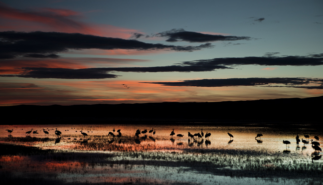

Dusk, North Pond, Chupadera Mountains, Bosque del Apache National Wildlife Refuge
The Refuge boundary is five miles south of the intersection of New Mexico State Road 1 and U.S. Route 380 in San Antonio. Immediately after entering the refuge are North and South ponds. North Pond (formally known as the Wetland Management Unit 3 pullout) is a great viewing area at sunrise and sunset. (3/6)
©Rich Beckman
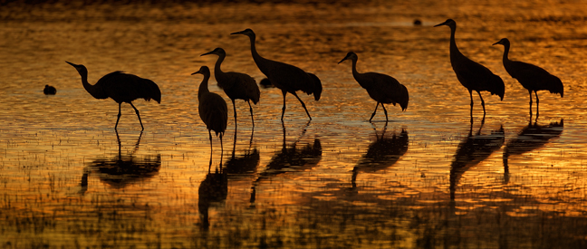

Dusk, North Pond, Chupadera Mountains, Bosque del Apache National Wildlife Refuge
The Refuge boundary is five miles south of the intersection of New Mexico State Road 1 and U.S. Route 380 in San Antonio. Immediately after entering the refuge are North and South ponds. North Pond (formally known as the Wetland Management Unit 3 pullout) is a great viewing area at sunrise and sunset. (4/6)
©Rich Beckman
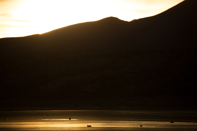

Dusk, North Pond, Chupadera Mountains, Bosque del Apache National Wildlife Refuge
The Refuge boundary is five miles south of the intersection of New Mexico State Road 1 and U.S. Route 380 in San Antonio. Immediately after entering the refuge are North and South ponds. North Pond (formally known as the Wetland Management Unit 3 pullout) is a great viewing area at sunrise and sunset. (5/6)
©Rich Beckman
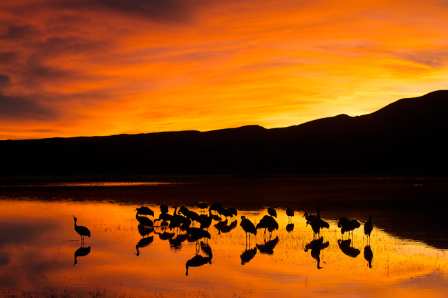

Dusk, North Pond, Chupadera Mountains, Bosque del Apache National Wildlife Refuge
The Refuge boundary is five miles south of the intersection of New Mexico State Road 1 and U.S. Route 380 in San Antonio. Immediately after entering the refuge are North and South ponds. North Pond (formally known as the Wetland Management Unit 3 pullout) is a great viewing area at sunrise and sunset. (6/6)
©Rich Beckman
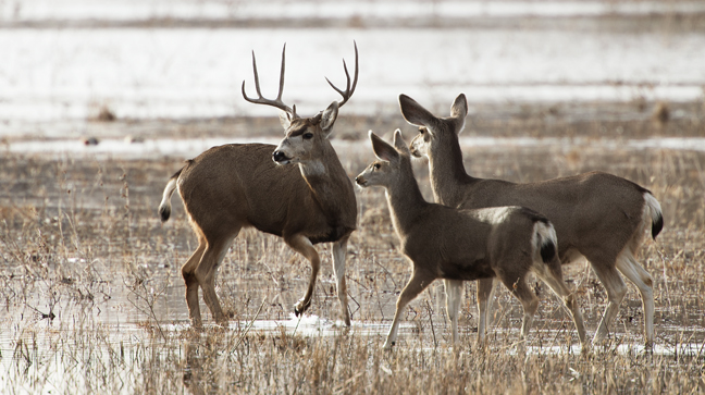

Mule Deer, South Loop, Bosque del Apache National Wildlife Refuge
The Refuge features two intersecting one-way auto tour routes. A small herd of mule deer can often be seen along the South Loop, also known as the Marsh Loop.
©Rich Beckman
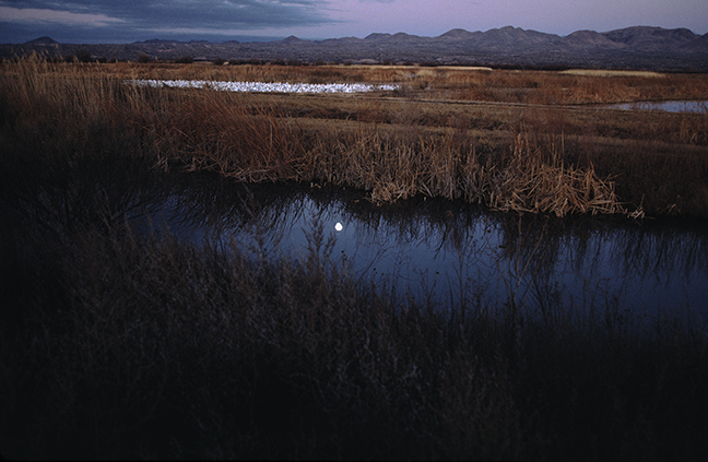

Dawn, North Loop, Bosque del Apache National Wildlife Refuge
The Bosque del Apache National Wildlife Refuge is situated between the Chupadera and San Pascual Mountains in southern New Mexico and features a wild stretch of the Rio Grande. In the 1930s, the Civilian Conservation Corps began to restore the floodplains in the area as wildlife habitat and in 1939, President Franklin Delano Roosevelt established the Refuge as part of a national system of lands dedicated to wildlife protection. In the winter, when the refuge is at its peak, thousands of geese rise en masse at sunrise and fly low to the north to spend the day feeding in the fields amidst thousands of wintering Sandhill Cranes. (1/10)
©Rich Beckman
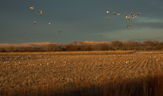

Dusk, North Loop, Bosque del Apache National Wildlife Refuge
The Refuge features two intersecting one-way auto tour routes. Near the end of the North Loop (Farm Loop) is the preferred feeding area for Sandhill Cranes. The staff and local farmers plant alfalfa, corn, winter wheat and clover to supplement food supplies for the wintering migratory birds. Every evening, between the Farm Deck and the Observation Blind, photographers and bird watchers gather to watch as the birds fly off to their evening roosts. (2/10)
©Rich Beckman
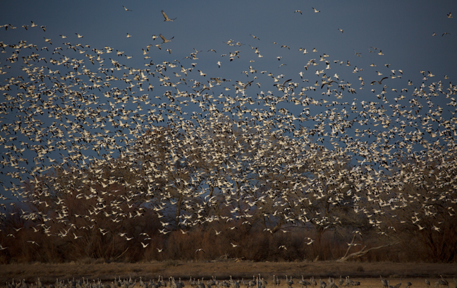

Dusk, North Loop, Bosque del Apache National Wildlife Refuge
The Refuge features two intersecting one-way auto tour routes. Near the end of the North Loop (Farm Loop) is the preferred feeding area for Sandhill Cranes. The staff and local farmers plant alfalfa, corn, winter wheat and clover to supplement food supplies for the wintering migratory birds. Every evening, between the Farm Deck and the Observation Blind, photographers and bird watchers gather to watch as the birds fly off to their evening roosts. (3/10)
©Rich Beckman
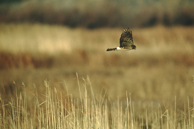

North Loop, Bosque del Apache National Wildlife Refuge
Northern Harriers (Marsh Hawks) breed throughout the Northern Hemisphere in Canada and the northernmost USA and migrate southerly for winter. They hunt small mammals in flight while hugging the land contours below, looking for voles, cotton rats and ground squirrels. They are the only hawk-like bird known to practice polygyny. Females are brown with varying degrees of streaking below, while males are gray with an unmarked lighter color below. In Eurasia, they are known as Hen Harriers. (4/10)
©Rich Beckman
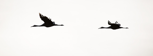

Dusk, North Loop, Bosque del Apache National Wildlife Refuge
The Refuge features two intersecting one-way auto tour routes. Near the end of the North Loop (Farm Loop) is the preferred feeding area for Sandhill Cranes. The staff and local farmers plant alfalfa, corn, winter wheat and clover to supplement food supplies for the wintering migratory birds. Every evening, between the Farm Deck and the Observation Blind, photographers and bird watchers gather to watch as the birds fly off to their evening roosts. (5/10)
©Rich Beckman
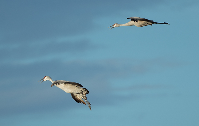

Dusk, North Loop, Bosque del Apache National Wildlife Refuge
The Refuge features two intersecting one-way auto tour routes. Near the end of the North Loop (Farm Loop) is the preferred feeding area for Sandhill Cranes. The staff and local farmers plant alfalfa, corn, winter wheat and clover to supplement food supplies for the wintering migratory birds. Every evening, between the Farm Deck and the Observation Blind, photographers and bird watchers gather to watch as the birds fly off to their evening roosts. (6/10)
©Rich Beckman
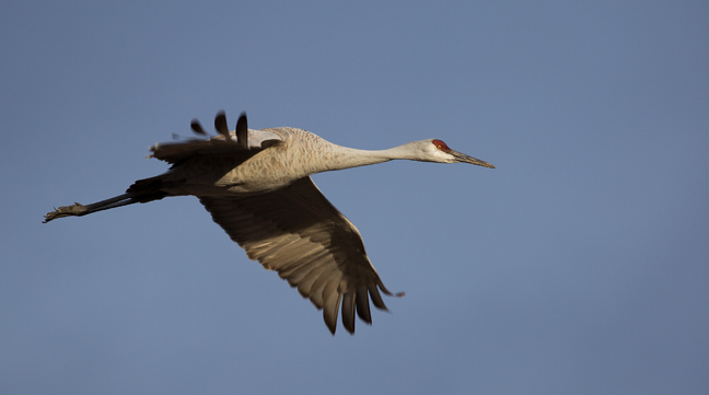

Dusk, North Loop, Bosque del Apache National Wildlife Refuge
The Refuge features two intersecting one-way auto tour routes. Near the end of the North Loop (Farm Loop) is the preferred feeding area for Sandhill Cranes. The staff and local farmers plant alfalfa, corn, winter wheat and clover to supplement food supplies for the wintering migratory birds. Every evening, between the Farm Deck and the Observation Blind, photographers and bird watchers gather to watch as the birds fly off to their evening roosts. (7/10)
©Rich Beckman
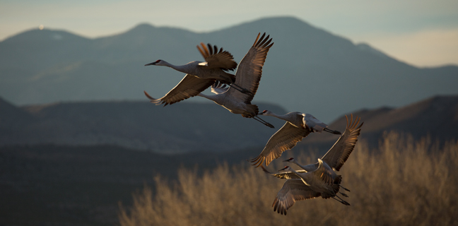

Dusk, North Loop, Bosque del Apache National Wildlife Refuge
The Refuge features two intersecting one-way auto tour routes. Near the end of the North Loop (Farm Loop) is the preferred feeding area for Sandhill Cranes. The staff and local farmers plant alfalfa, corn, winter wheat and clover to supplement food supplies for the wintering migratory birds. Every evening, between the Farm Deck and the Observation Blind, photographers and bird watchers gather to watch as the birds fly off to their evening roosts. (8/10)
©Rich Beckman
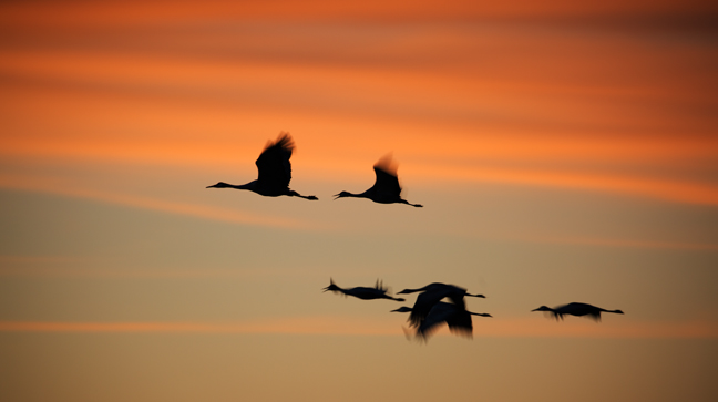

Dusk, North Loop, Bosque del Apache National Wildlife Refuge
The Refuge features two intersecting one-way auto tour routes. Near the end of the North Loop (Farm Loop) is the preferred feeding area for Sandhill Cranes. The staff and local farmers plant alfalfa, corn, winter wheat and clover to supplement food supplies for the wintering migratory birds. Every evening, between the Farm Deck and the Observation Blind, photographers and bird watchers gather to watch as the birds fly off to their evening roosts. (9/10)
©Rich Beckman
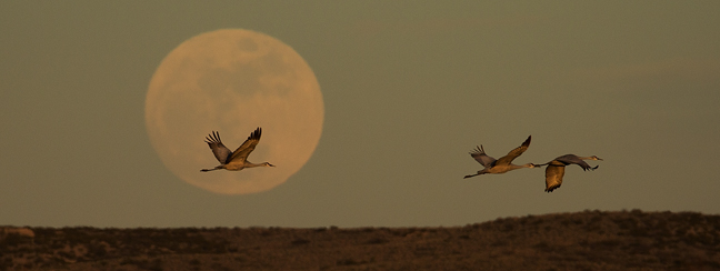

Dusk, North Loop, Bosque del Apache National Wildlife Refuge
The Refuge features two intersecting one-way auto tour routes. Near the end of the North Loop (Farm Loop) is the preferred feeding area for Sandhill Cranes. The staff and local farmers plant alfalfa, corn, winter wheat and clover to supplement food supplies for the wintering migratory birds. Every evening, between the Farm Deck and the Observation Blind, photographers and bird watchers gather to watch as the birds fly off to their evening roosts. (10/10)
©Rich Beckman