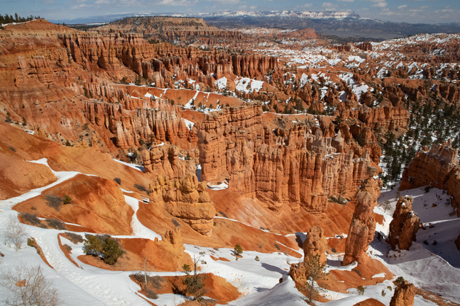

March 2019: Sunset Point Overlook, Bryce Canyon National Park, UT
There are many different ways to explore Canyon Country. During the last week of March, "Grandma Hattie" visited and we shared overlooks and short walks: a snowy Bryce Canyon, the Grand Wash of Capitol Reef, Devil's Garden in the Grand Staircase-Escalante, Goblin Valley, Dead Horse Point and Coal Mine Canyon. A week later, grade school friends Marilyn and Joel visited from Chicago and we hiked together for miles through North and South Coyote Buttes and watched the Milky Way rise and set behind the Paria Rimrock Hoodoos.
We'll never see it all, but most people never see it at all. The air is clean, the skies are dark, the stars and planets are bright and the best roads are dirt, clay and sand. The light is fickle and a sudden storm can strand you for days. It's impossible not to gain a newfound respect for the early settlers who traveled these same roads, rarely covering more than 20 miles on the best of days.
It's one of those rare places we keep coming back to, always seeing new things, each more wondrous than the last.
©Rich Beckman
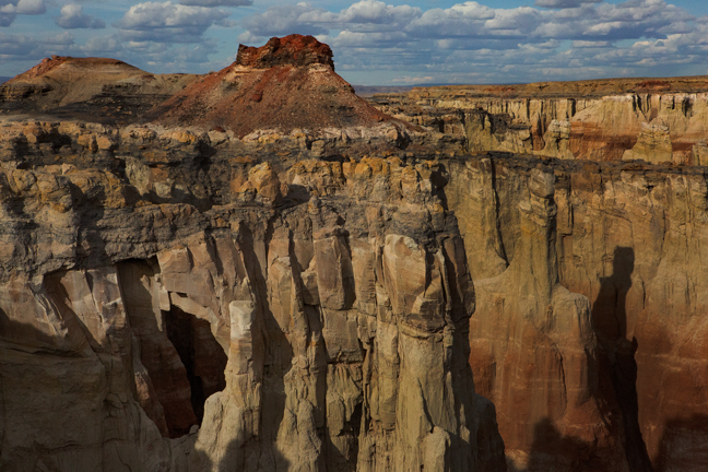

April 2019: Coal Mine Canyon, Navajo and Hopi Nations
The four-mile long Coal Mine Canyon features a variety of colorful spires, hoodoos, cliffs and fins and is composed of thin layers of soft Dakota Sandstone on top of thicker layers of Entrada Dakota Sandstone. There is now a path down to the canyon floor, about 400 feet below, just east of the picnic tables, with a steep descent bordered by rope railings.
The Canyon rim is on Navajo land and the Canyon floor is on Hopi land. The area is unposted, but some literature says that you need a Navajo permit to visit the rim and a Hopi guide to descend into the Canyon. I've been there a couple of times and have never seen any permits or guides, but both the Navajo and the Hopi are sovereign nations with their own legal systems, so it is best to follow their regulations. (1/3)
©Rich Beckman
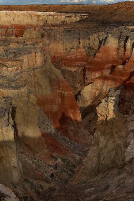

April 2019: Hiking in Coal Mine Canyon, Navajo and Hopi Nations, AZ
The four-mile long Coal Mine Canyon features a variety of colorful spires, hoodoos, cliffs and fins and is composed of thin layers of soft Dakota Sandstone on top of thicker layers of Entrada Dakota Sandstone. There is now a path down to the canyon floor, about 400 feet below, just east of the picnic tables, with a steep descent bordered by rope railings.
The Canyon rim is on Navajo land and the Canyon floor is on Hopi land. The area is unposted, but some literature says that you need a Navajo permit to visit the rim and a Hopi guide to descend into the Canyon. I've been there a couple of times and have never seen any permits or guides, but both the Navajo and the Hopi are sovereign nations with their own legal systems, so it is best to follow their regulations. (2/3)
©Rich Beckman
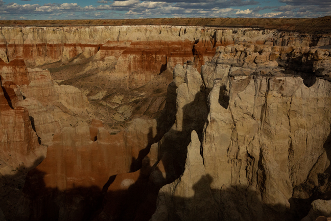

April 2019: Coal Mine Canyon, Navajo and Hopi Nations
The four-mile long Coal Mine Canyon features a variety of colorful spires, hoodoos, cliffs and fins and is composed of thin layers of soft Dakota Sandstone on top of thicker layers of Entrada Dakota Sandstone. There is now a path down to the canyon floor, about 400 feet below, just east of the picnic tables, with a steep descent bordered by rope railings.
The Canyon rim is on Navajo land and the Canyon floor is on Hopi land. The area is unposted, but some literature says that you need a Navajo permit to visit the rim and a Hopi guide to descend into the Canyon. I've been there a couple of times and have never seen any permits or guides, but both the Navajo and the Hopi are sovereign nations with their own legal systems, so it is best to follow their regulations. (3/3)
©Rich Beckman
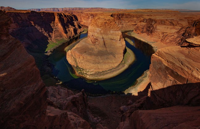

April 2019: Horseshoe Bend, Page, AZ
Horseshoe Bend is a natural horseshoe-shaped meander of the Colorado River, 1,000 feet below the viewing area, within the Glen Canyon National Recreation Area. The parking area is currently under construction and requires a five-dollar round-trip shuttle ride from a remote lot 2.5 miles to the northeast, off of Route 98. This is a major tourist destination, so be prepared for large crowds and lots of selfie-taking tourists along the edge of the viewing area.
©Rich Beckman
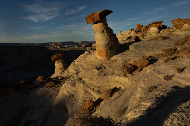

April 2019: Stud Horse Mesa, Page, AZ
Stud Horse Point is a narrow promontory at the end of a broad mesa spanning the Arizona/Utah state line about seven miles west of Page, AZ. Within a ravine along the four-wheel drive approach road are several large hoodoos and a view overlooking Lake Powell. (1/5)
©Rich Beckman
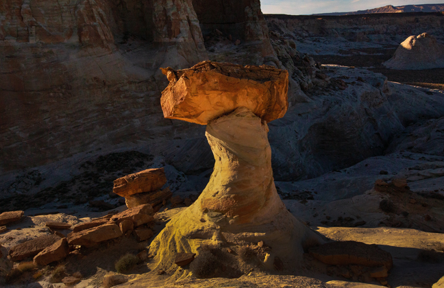

April 2019: Stud Horse Mesa, Page, AZ
Stud Horse Point is a narrow promontory at the end of a broad mesa spanning the Arizona/Utah state line about seven miles west of Page, AZ. Within a ravine along the four-wheel drive approach road are several large hoodoos and a view overlooking Lake Powell. (2/5)
©Rich Beckman
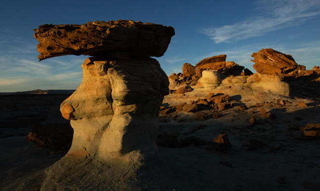

April 2019: Stud Horse Mesa, Page, AZ
Stud Horse Point is a narrow promontory at the end of a broad mesa spanning the Arizona/Utah state line about seven miles west of Page, AZ. Within a ravine along the four-wheel drive approach road are several large hoodoos and a view overlooking Lake Powell. (3/5)
©Rich Beckman
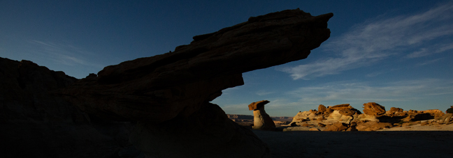

April 2019: Stud Horse Mesa, Page, AZ
Stud Horse Point is a narrow promontory at the end of a broad mesa spanning the Arizona/Utah state line about seven miles west of Page, AZ. Within a ravine along the four-wheel drive approach road are several large hoodoos and a view overlooking Lake Powell. (4/5)
©Rich Beckman
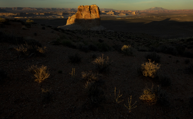

April 2019: Stud Horse Mesa, Page, AZ
Stud Horse Point is a narrow promontory at the end of a broad mesa spanning the Arizona/Utah state line about seven miles west of Page, AZ. Within a ravine along the four-wheel drive approach road are several large hoodoos and a view overlooking Lake Powell. (5/5)
©Rich Beckman
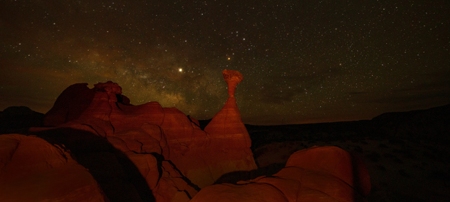

April 2019: Paria Rimrocks, Grand Staircase-Escalante National Monument, UT
Twelve miles west of Big Water, AZ is the parking area for The Paria Rimrocks, located in the Grand Staircase-Escalante National Monument. About 3/4 of a mile down the well-signed trail is the iconic Red Toadstool Hoodoo. This is not a place you head to for solitude. At 3 a.m., there were five cars in the small dirt parking lot and twelve people photographing the Red Toadstool Hoodoo in front of the Milky Way.
©Rich Beckman
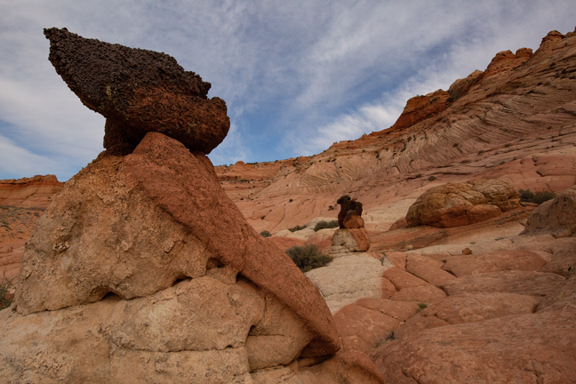

April 2019: Edmaiers Secret, Coyote Butte, UT
The rutted and washboard clay surface known as House Rock Valley Road stretches between Highways 89 and 89A, a distance of 29.5 miles through the Paria Canyon-Vermillion Cliffs Wilderness. Heading south 4.5 miles from Highway 89 is the Buckskin Gulch parking area. Buckskin Gulch is one of the longest continuous slot canyons in the world, roughly 16 miles long. On the east side of the Gulch, about a mile upstream from the start of the slot canyon is Edmaiers Secret, an area of layered domes, thin fins and large mounds comprised of thin sandstone plates. (1/5)
©Rich Beckman
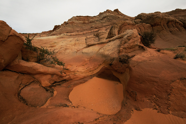

April 2019: Edmaiers Secret, Coyote Butte, UT
The rutted and washboard clay surface known as House Rock Valley Road stretches between Highways 89 and 89A, a distance of 29.5 miles through the Paria Canyon-Vermillion Cliffs Wilderness. Heading south 4.5 miles from Highway 89 is the Buckskin Gulch parking area. Buckskin Gulch is one of the longest continuous slot canyons in the world, roughly 16 miles long. On the east side of the Gulch, about a mile upstream from the start of the slot canyon is Edmaiers Secret, an area of layered domes, thin fins and large mounds comprised of thin sandstone plates. (2/5)
©Rich Beckman
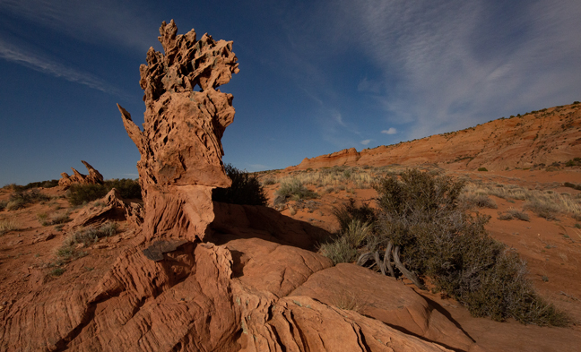

April 2019: Edmaiers Secret, Coyote Butte, UT
The rutted and washboard clay surface known as House Rock Valley Road stretches between Highways 89 and 89A, a distance of 29.5 miles through the Paria Canyon-Vermillion Cliffs Wilderness. Heading south 4.5 miles from Highway 89 is the Buckskin Gulch parking area. Buckskin Gulch is one of the longest continuous slot canyons in the world, roughly 16 miles long. On the east side of the Gulch, about a mile upstream from the start of the slot canyon is Edmaiers Secret, an area of layered domes, thin fins and large mounds comprised of thin sandstone plates. (3/5)
©Rich Beckman
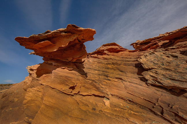

April 2019: Edmaiers Secret, Coyote Butte, UT
The rutted and washboard clay surface known as House Rock Valley Road stretches between Highways 89 and 89A, a distance of 29.5 miles through the Paria Canyon-Vermillion Cliffs Wilderness. Heading south 4.5 miles from Highway 89 is the Buckskin Gulch parking area. Buckskin Gulch is one of the longest continuous slot canyons in the world, roughly 16 miles long. On the east side of the Gulch, about a mile upstream from the start of the slot canyon is Edmaiers Secret, an area of layered domes, thin fins and large mounds comprised of thin sandstone plates. (4/5)
©Rich Beckman
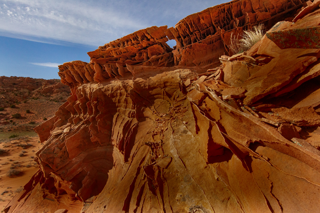

April 2019: Edmaiers Secret, Coyote Butte, UT
The rutted and washboard clay surface known as House Rock Valley Road stretches between Highways 89 and 89A, a distance of 29.5 miles through the Paria Canyon-Vermillion Cliffs Wilderness. Heading south 4.5 miles from Highway 89 is the Buckskin Gulch parking area. Buckskin Gulch is one of the longest continuous slot canyons in the world, roughly 16 miles long. On the east side of the Gulch, about a mile upstream from the start of the slot canyon is Edmaiers Secret, an area of layered domes, thin fins and large mounds comprised of thin sandstone plates. (5/5)
©Rich Beckman
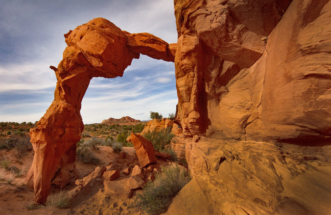

April 2019: Flame Arch, Coyote Butte, UT
Heading south on House Rock Road 8.3 miles from Highway 89 is the Wire Pass Canyon parking area. After following the trail for 1.1 miles, just before the first set of narrows, is a short canyon and ridge to the south that leads to Flame (37 0.624', -112 0.992') and Moby Dick (37 0.442', -112 1.037') natural arches. The first part of the trail is shared with permit holders for The Wave in North Coyote Butte. Entering the permit area without a permit can result in a fine of $1,200 per person, so don't miss the turn.
©Rich Beckman
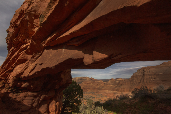

April 2019: Moby Dick Arch, Coyote Butte, UT
Heading south 8.3 miles from Highway 89 is the Wire Pass Canyon parking area. After following the trail for 1.1 miles, just before the first set of narrows, is a short canyon and ridge to the south that leads to Flame (37 0.624', -112 0.992') and Moby Dick (37 0.442', -112 1.037') natural arches. The first part of the trail is shared with permit holders for The Wave in North Coyote Butte. Entering the permit area without a permit can result in a fine of $1,200 per person, so don't miss the turn.
©Rich Beckman
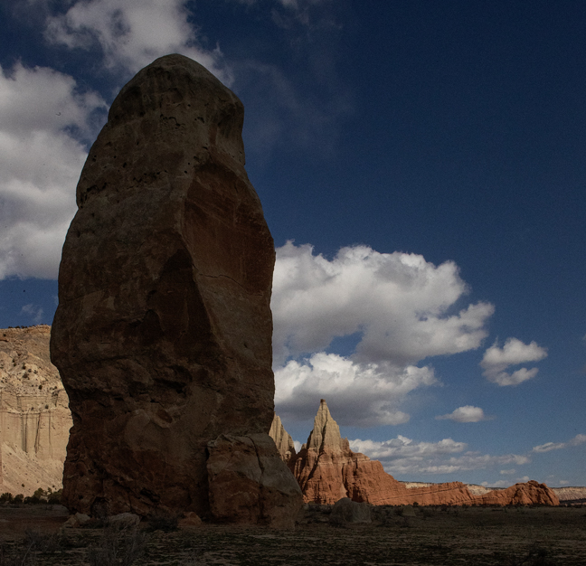

March 2019: Kodachrome Basin State Park, Cannonville, UT
By following Highway 89 to Kanab and then north to Scenic Byway 12, you will pass by Cannonville and the access road to Kodachrome Basin State Park, site of 67 monolithic stone spires, called sedimentary pipes. The tallest, at 170 ft., is known as Chimney Rock. Just outside the park entrance the paved section of Cottonwood Canyon Road ends, but the road continues for another 37 miles through the Grand Staircase-Escalante all the way to Highway 89, about 15 miles west of Big Water, UT. Both times I've been in the Koadachrome Basin, Cottonwood Canyon Road was closed due to flooding.
©Rich Beckman
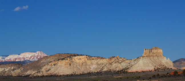

March 2019: Cottonwood Canyon Road, UT
The view to the northwest looking toward Bryce Canyon National Park from Cottonwood Canyon Road just outside of Kodachrome Basin State Park, UT.
©Rich Beckman
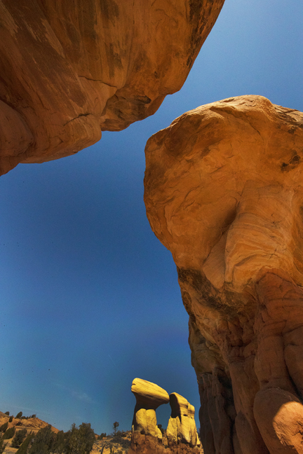

March 2019: Devil's Garden, Grand Staircase-Escalante National Monument, UT
The northern access to Grand Staircase-Escalante is via Hole-in-the-Rock Road just outside the town of Escalante, UT. Apparently, Mormon settlers created a hole in the rock, a notch wide enough to lower their wagons along a thousand foot cliff along the Colorado River, which they planned to cross. The 62-mile dirt road to this spot from the town of Escalante is named for this feat. At mile 12.3 from UT 12 is the parking area for Devil's Garden, a small area of Navajo Sandstone hoodoos and Metate and Mano natural arches.
©Rich Beckman
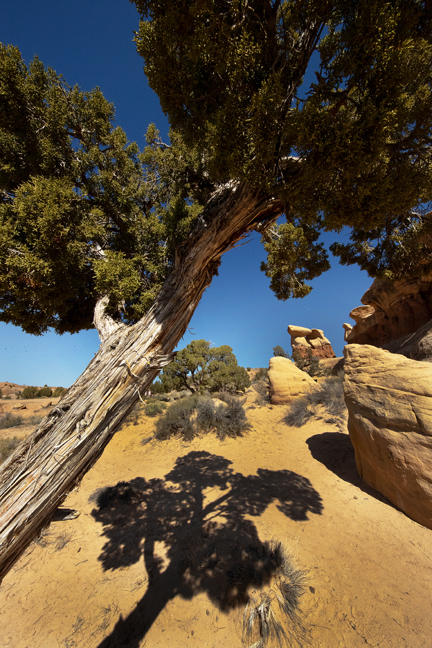

March 2019: Devil's Garden, Grand Staircase-Escalante National Monument, UT
The northern access to Grand Staircase-Escalante is via Hole-in-the-Rock Road just outside the town of Escalante, UT. Apparently, Mormon settlers created a hole in the rock, a notch wide enough to lower their wagons along a thousand foot cliff along the Colorado River, which they planned to cross. The 62-mile dirt road to this spot from the town of Escalante is named for this feat. At mile 12.3 from UT 12 is the parking area for Devil's Garden, a small area of Navajo Sandstone hoodoos and Metate and Mano natural arches.
©Rich Beckman
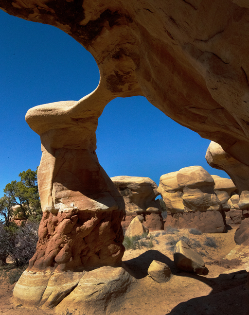

March 2019: Metate Arch, Devil's Garden, Grand Staircase-Escalante National Monument, UT
The northern access to Grand Staircase-Escalante is via Hole-in-the-Rock Road just outside the town of Escalante, UT. Apparently, Mormon settlers created a hole in the rock, a notch wide enough to lower their wagons along a thousand foot cliff along the Colorado River, which they planned to cross. The 62-mile dirt road to this spot from the town of Escalante is named for this feat. At mile 12.3 from UT 12 is the parking area for Devil's Garden, a small area of Navajo Sandstone hoodoos and Metate and Mano natural arches.
©Rich Beckman
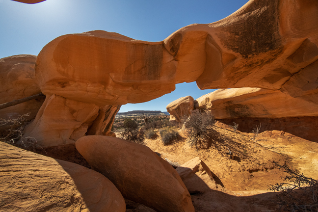

March 2019: Mano Arch, Grand Staircase-Escalante National Monument, UT
The northern access to Grand Staircase-Escalante is via Hole-in-the-Rock Road just outside the town of Escalante, UT. Apparently, Mormon settlers created a hole in the rock, a notch wide enough to lower their wagons along a thousand foot cliff along the Colorado River, which they planned to cross. The 62-mile dirt road to this spot from the town of Escalante is named for this feat. At mile 12.3 from UT 12 is the parking area for Devil's Garden, a small area of Navajo Sandstone hoodoos and Metate and Mano natural arches.
©Rich Beckman
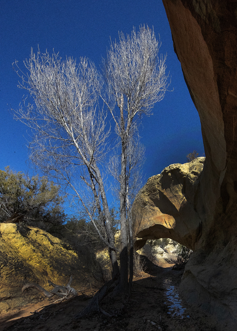

March 2019: Covered Wagon Bridge, Grand Staircase-Escalante National Monument, UT
Covered Wagon Natural Bridge (37 39.783', -111 33.760') is off of Cedar Wash Road, in the Grand Staircase National Monument, about 9.2 miles off Highway 12 in Escalante.
©Rich Beckman
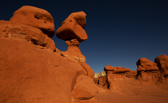

March 2019: Goblin Valley State Park, UT
Since we were in the area and had a Utah State Parks pass, we decided to return home via Goblin Valley and Dead Horse Point State Parks. (1/2)
©Rich Beckman
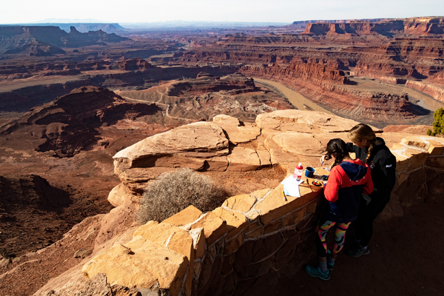

March 2019: School Girls Painting, Dead Horse Point State Park, UT
Since we were in the area and had a Utah State Parks pass, we decided to return home via Goblin Valley and Dead Horse Point State Parks. (2/2)
©Rich Beckman